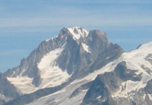
Aiguille d'Argentière
| Aiguille d'Argentière | ||
|---|---|---|
|
Aiguille d'Argentière |
||
| height | 3901 m above sea level M. | |
| location | Switzerland , France | |
| Mountains | Mont Blanc massif | |
| Dominance | 4 km → Les Droites | |
| Notch height | 473 m ↓ Brêche de l'Amône | |
| Coordinates , ( CH ) | 45 ° 57 '35 " N , 7 ° 1' 13" O ( 567 563 / 89881 ) | |
|
|
||
| First ascent | July 15, 1864 by Edward Whymper and A. Reilly with the guides Michel Croz , M. Payot, H. Charlet (west flank and northwest ridge) | |
| Normal way | Southwest flank | |
|
Aiguille d'Argentière (right) and Aiguille du Chardonnet , |
||
The Aiguille d'Argentière is 3901 m above sea level. M. high mountain on the border between France and Switzerland .
The first to climb was Edward Whymper in 1864, who was also the first to climb the Barre des Écrins , Aiguille Verte and the Matterhorn . It was the undoing of the well-known and very experienced French mountaineer Stéphane Brosse in 2012. Tobias Haag, the brother of 2014 in Tibet crashed Extremskibergsteigers Sebastian Haag , crashed here in April 2006, also fatal.
Web links
Commons : Aiguille d'Argentière - Collection of images, videos and audio files
Individual evidence
- ↑ An interview with extreme mountaineer Basti Haag , Powderguide, January 10, 2013.


