Akaiwa
| Akaiwa-shi 赤 磐 市 |
||
|---|---|---|
|
|
||
| Geographical location in Japan | ||
| Region : | Chūgoku | |
| Prefecture : | Okayama | |
| Coordinates : | 34 ° 45 ' N , 134 ° 1' E | |
| Basic data | ||
| Surface: | 209.43 km² | |
| Residents : | 42,628 (October 1, 2019) |
|
| Population density : | 204 inhabitants per km² | |
| Community key : | 33213-5 | |
| town hall | ||
| Address : |
Akaiwa City Hall 311 - 1 , Shimoichi Akaiwa -shi Okayama 715-8601 |
|
| Website URL: | http://www.city.akaiwa.lg.jp | |
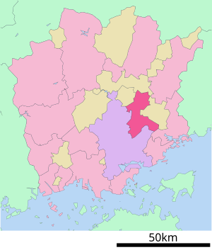
| Location Akaiwas in Okayama Prefecture | ||
Akaiwa ( Japanese 赤 磐 市 , - shi , literally: red rock ) is a city with around 45,000 inhabitants in the Japanese prefecture of Okayama .
history
The municipal administrative unit Akaiwa was formed on March 7, 2005 from the union of the municipalities Akasaka ( 赤 坂 町 , -chō ), Kumayama ( 熊 山 町 , -chō ), Sanyō ( 山陽 町 , -chō ) and Yoshii ( 吉 井 町 , -chō ) of Akaiwa County.
Attractions
The main attractions of the city include the Kumayama ruins ( 熊 山 遺跡 , Kumayama iseki ), an important Buddhist testimony to the early Nara period, and the Isonokamifutsumitama shrine ( 石 上 布 都 魂 神社 , Isonokamifutsumitama-jinja )
traffic
The city is accessible by road through the Sanyo motorway and the national roads 374 and 484. It is also on the JR railways and the Sanyo main line .
Neighboring cities and communities
Akaiwa borders the capital of Okayama Prefecture to the west and Bizen to the east .


