Aloha (Oregon)
| Aloha | ||
|---|---|---|
 |
||
| Location in Oregon | ||
|
|
||
| Basic data | ||
| State : | United States | |
| State : | Oregon | |
| County : | Washington County | |
| Coordinates : | 45 ° 30 ′ N , 122 ° 52 ′ W | |
|
Inhabitants : - Metropolitan Area : |
49,425 (as of 2010) 2,453,000 (as of 2017) |
|
| Population density : | 2,587.7 inhabitants per km 2 | |
| Area : | 19.1 km 2 (approx. 7 mi 2 ) of which 19.1 km 2 (approx. 7 mi 2 ) is land |
|
| Height : | 64 m | |
| Postcodes : | 97003, 97006-97007, 97078 | |
| Area code : | +1 503 & 971 | |
| FIPS : | 41-01650 | |
| GNIS ID : | 1116889 | |
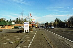
Aloha is a census-designated place in Washington County in the state of Oregon in the United States . The town is located in the greater Portland area and had 49,425 inhabitants at the 2010 census . An estimate from 2017 is based on 55,205 inhabitants.
geography
According to the United States Census Bureau , Aloha has a total area of just over 19 km², none of which is water. It is west of Portland, surrounded by other cities and places with a suburban character. In the east lies the Willamette River with Portland and in the northeast the Columbia River flows . Directly to the east of the Aloha area is the city of Beaverton and Hillsboro to the northwest .
Oregon State Route 8 and 10 runs through the town .
Demographics
| Population development | |||
|---|---|---|---|
| Census | Residents | ± in% | |
| 1980 | 28,353 | - | |
| 1990 | 34,284 | 20.9% | |
| 2000 | 41,741 | 21.8% | |
| 2010 | 49,425 | 18.4% | |
| 2017 estimate | 55.205 | 11.7% | |
| Source. Results of the census | |||
The 2010 census counted 49,425 inhabitants in 18,628 households. Every household had while an average income of 71,076 US dollars . Of the total population, 88.4% had a high school or higher education degree and 13.8% were below the poverty line. The mean age was 34.2 years.
Web links
Individual evidence
- ↑ a b c d Aloha CDP, Oregon. United States Census Bureau, accessed March 24, 2019 .
