Alpeiner Scharte
| Alpeiner Scharte | |||
|---|---|---|---|
|
On the Alpeiner Scharte. In the background the Stubai Alps |
|||
| Compass direction | east | west | |
| Pass height | 2959 m above sea level A. | ||
| state | Tyrol | ||
| Valley locations | Finkenberg | Vals | |
| expansion | Mountain path | ||
| Mountains | Zillertal Alps | ||
| Map (Tyrol) | |||
|
|
|||
| Coordinates | 47 ° 2 '14 " N , 11 ° 38' 58" E | ||
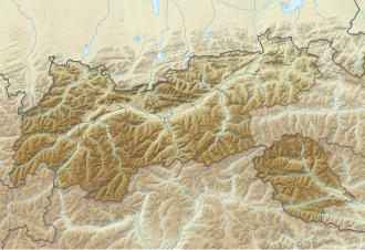
The Alpeiner Scharte is a notch in the Zillertal Alps , in the Austrian state of Tyrol , east of the Valser Valley . It is located at an altitude of 2959 meters between the peaks of Fußstein and Schrammacher .
On the west side below the Alpeiner Scharte there is a molybdenum deposit described by the Tyrolean cartographer Peter Anich in 1774 .
Molybdenum mine
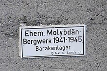
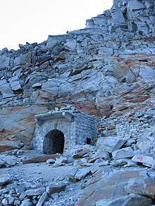
Because it was used to refine steel, molybdenum was of great strategic importance. With the beginning of the Second World War , the German arms industry was almost cut off from imports of this metal by the Allied embargo. Then in 1941 the Treibacher Chemische Werke AG , based in Treibach in Carinthia, began exploring the deposit located at 2850 m above sea level. To develop this deposit, the Tiroler Erzbergbaugesellschaft mbH, based in St. Jodok am Brenner, was founded by Treibacher Chemischen Werke AG on January 17, 1942 . She is one hundred percent owner of the mining company. In 1943, the Sachsenz Bergwerksgesellschaft mbH, based in Freiberg, signed a consultancy agreement with the Treibacher Chemische Werke AG for the investigation and mining of the molybdenum deposit on the Alpeiner Scharte. This contract was signed on May 2, 1943 in Freiberg by Hans Junker (Bergdirektor of the Sachsenz Bergwerksgesellschaft mbH) and on May 17, 1943 in Treibach by Fritz Gamillscheg (General Director of Treibacher Chemischen Werke AG) and entered into with the approval of the Reich Economics Minister on May 2 June 1943 in force. In order to secure the processing of part of the extracted molybdenum, another contract was signed between the two companies on August 18, 1943 in Innsbruck . It includes the takeover of 10 percent of the 100,000 RM original contribution of the Tiroler Erzbergwerksgesellschaft mbH by Sachsz Bergwerks mbH. The ore concentrates obtained are delivered according to the ratio of the participation. A representative of Sachsenz Bergwerksgesellschaft mbH is elected to the supervisory board of Tiroler Bergwerksgesellschaft mbH. Furthermore, the option to take over another 40 percent of the capital contribution is kept open. The Tiroler Bergwerksgesellschaft mbH joins the contract from 2./17. May 1943 at. In a contract signed on January 8, 1945 in Innsbruck, the now Sachsenz Bergwerks AG takes over another RM 40,000 of the share capital of the Tiroler Bergwerksgesellschaft mbH. The undersigned are again Hans Junker and Fritz Gamillscheg. Road extensions, a 4980 meter long material ropeway, a processing plant (in the valley), a hydroelectric power station and power lines, the tunnel itself, as well as a first workers' camp at the Geraer Hütte (still existing outbuilding), and later at the tunnel mouth hole three, were used to develop the deposit Workers' barracks required. According to the investigations by Thomas Brandt and Wolfgang Meixner, forced laborers from Eastern Europe and a smaller number of people recruited in Italy were used in addition to local workers.
In an avalanche accident on November 11, 1944, 22 workers and employees were killed. At that time, 143 workers and employees (73 of them Eastern workers) lived in the barracks. 75 workers were employed by the mining company (including 20 workers from the East) and 68 workers (including 53 from the East) at a construction company in Innsbruck. The expansion of the mine continued after this accident. In February 1945 an Italian, the carpenter Luigi Zanella, from the Auschwitz concentration camp was assigned to the project as a work slave. Almost nothing is known to this day about the fate of the forced laborers who cut the mining site into the rock, although some of them were reported to the police on site . The mined ore was to be transported by cable car down through the entire valley to the processing plant near the Nockeralm . On May 3rd, after the occupation of Innsbruck by the Allies, operations on the Alpeiner Scharte were finally stopped.
Despite all these tremendous efforts, the smallest amount of molybdenum could never be extracted.
Due to the risk of falling, the ruins of the processing plant were blown up by the Austrian army in 1989 . About 600 meters in altitude below the saddle, information on the history of the mine is available in the Geraer Hütte on the Vals side .
map
- Alpine Club Map 1: 25,000, sheet 35/1, Zillertal Alps West
Web links
- The molybdenum mine on the Alpeiner Scharte : A contemporary historical documentation
- Florian Gasser: studs for victory. Subtitle: The Nazis built a mine high in the Tyrolean Alps to extract a raw material that was essential to the war effort. In: The time of July 16, 2010
literature
- Thomas Brandt: The molybdenum mine on the Alpeiner Scharte, diploma thesis, Innsbruck 2011.


