Ohlsbach
| coat of arms | Germany map | |
|---|---|---|

|
Coordinates: 48 ° 26 ' N , 8 ° 0' E |
|
| Basic data | ||
| State : | Baden-Württemberg | |
| Administrative region : | Freiburg | |
| County : | Ortenau district | |
| Height : | 181 m above sea level NHN | |
| Area : | 11.14 km 2 | |
| Residents: | 3284 (December 31, 2018) | |
| Population density : | 295 inhabitants per km 2 | |
| Postal code : | 77797 | |
| Area code : | 07803 | |
| License plate : | OG, BH , KEL, LR, WOL | |
| Community key : | 08 3 17 097 | |
| Address of the municipal administration: |
Hauptstrasse 33 77797 Ohlsbach |
|
| Website : | ||
| Mayor : | Bernd brother | |
| Location of the community of Ohlsbach in the Ortenau district | ||
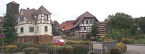
Ohlsbach is a municipality in the Ortenaukreis in Baden-Württemberg . The wine and holiday resort with numerous half-timbered houses is on the Baden Wine Route .
geography
Geographical location
Ohlsbach is located in the foothills of the Black Forest in the Kinzig valley in a quiet location a little off the federal highway 33 . The Ohlsbach district is 1114 ha, of which agricultural and forestry: 900 ha, of which 600 ha is forest and 300 ha is used for agriculture.
Neighboring communities
The community borders in the north on Durbach , in the east on Reichenbach (Gengenbach) , in the south on Berghaupten and in the west on Ortenberg and the district town of Offenburg .
Community structure
The village of Ohlsbach, the hamlets of Büchen, Ebersweier, Nothalde, Schlauch and Weißenbach and the farms of Hinterohlsbach and Meisengrund belong to the municipality of Ohlsbach. The villages of Hubersgasse and Schindelhof, which were dissolved in Ohlsbach, were located in the municipality.
history
The first known mention of the place name dates from the year 1234. It is Olespach and is interpreted as Aalbach after the brook or as the brook of Olo after the first settler. However, it can be assumed that there was a settlement long before this.
The oldest districts are the village, Hinterohlsbach, Ebersweier and Büchen. Ohlsbach is a scattered settlement. There are no more of the first houses. In 1689 the village was burned down except for two houses. Modern properties were built over the foundations of the latter two. In 1402 Ohlsbach declared his accession to the city republic of Gengenbach. The original of the contract is in the municipal archive. When the Ohlsbacher joined the city, they declared themselves a guild. They vowed loyalty and obedience to the city authorities.
The city itself promised not to diminish the old rights of the Ohlsbachers. These are guaranteed in the "old tradition", the original of which is also in the community archive. Ohlsbach thus fully joined the Gengenbacher community association, but always retained a special position due to his assets and his own income. The Ohlsbacher also secured the exit from the association.
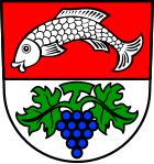
When the city-state of Gengenbach was dissolved in 1803 and the individual parish communities became independent, Ohlsbach withdrew only with the property that had been brought in, while the other new communities received shares in the former imperial city markings. Three wayside shrines with vines in the coat of arms indicate that Ohlsbach was an ancient, free village community with extensive viticulture. During the municipal reform in 1973/1974, Ohlsbach was able to maintain its independence, despite its eventful history with alternating ownership interests. Today the original image of the former predominantly rural community has changed. In addition to agriculture and forestry, medium-sized businesses increasingly form the basis of Ohlsbach, but viticulture and tourism are also important.
politics
Administrative community
The community belongs to the agreed administrative community of the city of Gengenbach.
mayor
- In February 2012, Bernd Bruder (* 1962) was elected to succeed Horst Wimmer.
Municipal council
The local council in Ohlsbach has 12 members. It consists of the elected honorary councilors and the mayor as chairman. The mayor is entitled to vote in the municipal council. The local elections on May 26, 2019 led to the following final result.
| Parties and constituencies |
% 2019 |
Seats 2019 |
% 2014 |
Seats 2014 |
||
| CDU | Christian Democratic Union of Germany | 49.1 | 6th | 50.69 | 6th | |
| FW | Free electoral association | 50.9 | 6th | 49.31 | 6th | |
| total | 100.0 | 12 | 100.0 | 12 | ||
| voter turnout | 72.6% | 61.9% | ||||
Partnerships
Ohlsbach has a partnership with the following city :
Attractions
They are worth seeing
and the
- Mineral fountain system ,
fed by a salt spring , which is a free outlet for high saline water from the crystalline basement into the Kinzig valley. The "salt flag" can be traced into the Rhine. The exit points are partially set in wells. Salt is extracted in a local graduation house. The community of Ohlsbach has had a mineral fountain system with pure mineral brine water with a water treading basin and graduation system since 1982. The brine obtained by a pump trickles over mountain fir branches and absorbs aromatic resins and essential oils, which are sprayed into the breath of the visitor. This recreation site is maintained by a specially founded association.
Economy and Infrastructure
education
There is a primary school in Ohlsbach, the Weinbergschule. All secondary schools are available in Gengenbach or the nearby district town of Offenburg.
Sports ground
The new sports area on the Brumatt includes a multi-purpose hall, two grass and one hard court and an athletics facility. A football field and basketball hoops are also available for young people who do not belong to any club. Next to the hall is the fire station with the rehearsal room of the music club and the club house of the gymnastics club. The facilities mentioned are up to date and have no comparable competitors in the region.
The club house and the three courts of the tennis club are located near the sports grounds. The lane golf club plays on the mini golf course in the center of the village (near the town hall).
Mardi Gras
The local fools guild are the Umbeisen and witches.
A tradition that is unique in the region is the recruits, a group that is formed anew every year from young people from one year of the village. Probably formed in the period after the Second World War, the recruits, as the name suggests, were male youths drafted into military service. During the carnival season they formed their own group to celebrate the farewell to civil life together. Today women are also allowed. A tradition of the recruits is the Schiewerädli shooting ( slamming of discs ), whereby burning wooden discs are thrown from a hill into the vineyards at night.
Web links
Individual evidence
- ↑ State Statistical Office Baden-Württemberg - Population by nationality and gender on December 31, 2018 (CSV file) ( help on this ).
- ^ The state of Baden-Württemberg. Official description by district and municipality. Volume VI: Freiburg administrative region. Kohlhammer, Stuttgart 1982, ISBN 3-17-007174-2 . Pp. 326-327.
- ↑ https://www.bo.de/lokales/offenburg/bernd-bruder-ist-neuer-buergermeister


