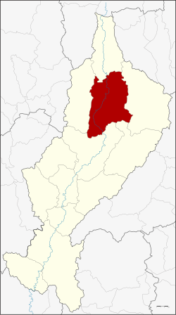
Chae Hom district
|
Chae Hom แจ้ห่ม |
|
|---|---|
| Province: | Lampang |
| Surface: | 1349.121 km² |
| Residents: | 40,575 (2013) |
| Population density : | 31.5 U / km² |
| ZIP : | 52120 |
| Geocode : | 5206 |
| map | |

|
|

Amphoe Chae Hom ( Thai อำเภอ แจ้ห่ม , pronunciation: ʔāmpʰɤ̄ː tɕɛ̂ː hòm ) is a district ( Amphoe - administrative district) in the north of the province of Lampang . The Lampang Province is located in the northern region of Thailand .
geography
Neighboring counties (clockwise from north): Wang Nuea , Ngao , Mae Mo , Mueang Lampang and Mueang Pan districts of Lampang Province.
The Chae Son National Park (Thai: อุทยานแห่งชาติ แจ้ ซ้อน ) is partly located in the Chae Hom County.
The Mae Nam Wang (Wang River) flows through the district .
administration
Provincial Administration
Chae Hom County is divided into seven tambon ("subdistricts" or "parishes"), which are further subdivided into 64 muban ("villages").
| No. | Surname | Thai | Muban | Pop. |
|---|---|---|---|---|
| 1. | Chae Hom | แจ้ห่ม | 11 | 8.205 |
| 2. | Ban Sa | บ้าน สา | 10 | 5,090 |
| 3. | Pong Don | ป ง ดอน | 8th | 4,842 |
| 4th | Mae Suk | แม่ สุก | 12 | 7.187 |
| 5. | Mueang May | เมือง มา ย | 6th | 3,346 |
| 6th | Thung Phueng | ทุ่ง ผึ้ง | 6th | 4,056 |
| 7th | Wichet Nakhon | วิ เช ต นคร | 11 | 7,849 |
Local administration
There are three municipalities with "small town" status ( Thesaban Tambon ) in the district:
- Chae Hom (Thai: เทศบาล ตำบล แจ้ห่ม ) consisting of parts of the Tambon Chae Hom.
- Ban Sa (Thai: เทศบาล ตำบล บ้าน สา ) consisting of the complete tambon Ban Sa.
- Thung Phueng (Thai: เทศบาล ตำบล ทุ่ง ผึ้ง ) consisting of the complete tambon Thung Phueng.
There are also five " tambon administration organizations " ( องค์การ บริหาร ส่วน ตำบล - Tambon Administrative Organizations, TAO)
- Chae Hom (Thai: องค์การ บริหาร ส่วน ตำบล แจ้ห่ม ) consisting of parts of the Tambon Chae Hom.
- Pong Don (Thai: องค์การ บริหาร ส่วน ตำบล ป ง ดอน ) consisting of the complete Tambon Pong Don.
- Mae Suk (Thai: องค์การ บริหาร ส่วน ตำบล แม่ สุก ) consisting of the complete Tambon Mae Suk.
- Mueang Mai (Thai: องค์การ บริหาร ส่วน ตำบล เมือง มา ย ) consisting of the complete tambon Mueang Mai.
- Wichet Nakhon (Thai: องค์การ บริหาร ส่วน ตำบล วิ เช ต นคร ) consisting of the complete tambon Wichet Nakhon.
Individual evidence
- ↑ 2013 population statistics ( Thai ) Department of Provincial Administration. Retrieved October 27, 2014.
Web links
- More information about Amphoe Chae Hom from amphoe.com (in Thai)
- Information about the Chae Son National Park (in English)
Coordinates: 18 ° 43 ' N , 99 ° 33' E

