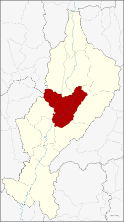
Amphoe Mueang Lampang
|
Mueang Lampang เมือง ลำปาง |
|
|---|---|
| Province: | Lampang |
| Surface: | 1156.6 km² |
| Residents: | 231,269 (2013) |
| Population density : | 205.2 U / km² |
| ZIP : | 52000, 52100, 52220 |
| Geocode : | 5201 |
| map | |

|
|
Amphoe Mueang Lampang ( Thai : อำเภอ เมือง ลำปาง , pronunciation: ʔāmpʰɤ̄ː mɯ̄aŋ lām.pāːŋ ) is a district ( amphoe - administrative district) in the province of Lampang . The Lampang Province is located in the northern region of Thailand . The capital of the province of Lampang is also called Lampang .
geography
Lampang is about 100 kilometers south-east of Chiang Mai in a wide plain of Maenam Wang , the distance to the capital Bangkok is about 600 kilometers.
Neighboring districts are (from north clockwise): Amphoe Mueang Pan , Chae Hom , Mae Mo , Mae Tha , Ko Kha and Hang Chat the province of Lampang, Amphoe Mae Tha of Lamphun province and Amphoe Mae On the Chiang Mai province .
education
The Rajabhat University of Lampang and a sub-campus of the Technical University of Rajamangala Lanna are located in Amphoe Mueang Lampang .
administration
Provincial Administration
Mueang Lampang County is divided into 19 tambon ("subdistricts" or "municipalities"), which are further subdivided into 183 Muban ("villages").
| No. | Surname | Thai | Muban | Pop. |
|---|---|---|---|---|
| 1. | Wiang Nuea | เวียง เหนือ | - | 11,161 |
| 2. | Hua Wiang | หัว เวียง | - | 7,585 |
| 3. | Suan Dok | สวน ดอก | - | 4,891 |
| 4th | Sop Tui | สบ ตุ๋ ย | - | 13,990 |
| 5. | Phra Bat | พระบาท | 8th | 22.092 |
| 6th | Chomphu | ชมพู | 14th | 26,299 |
| 7th | Kluai Phae | กล้วย แพะ | 6th | 9,398 |
| 8th. | Pong Saen Thong | ป ง แสน ทอง | 11 | 17,725 |
| 9. | Ban Laeng | บ้าน แลง | 12 | 6,797 |
| 10. | Ban Sadet | บ้าน เสด็จ | 17th | 10,872 |
| 11. | Phichai | พิชัย | 17th | 24,308 |
| 12. | Thung Fai | ทุ่ง ฝาย | 10 | 7,886 |
| 13. | Ban Ueam | บ้าน เอื้อม | 15th | 10.190 |
| 14th | Ban Pao | บ้าน เป้า | 12 | 6,812 |
| 15th | Ban Kha | บ้าน ค่า | 8th | 5,676 |
| 16. | Bo Haeo | บ่อ แฮ้ ว | 17th | 19,396 |
| 17th | Clay thong chai | ต้น ธงชัย | 13 | 15,957 |
| 18th | Nikhom Phatthana | นิคม พัฒนา | 14th | 5,190 |
| 19th | Bunnak Phatthana | บุญนาค พัฒนา | 9 | 5,044 |
Local administration
There is one commune with "big city" status ( Thesaban Nakhon ) in the county:
- Lampang (Thai: เทศบาล นคร ลำปาง ) consisting of the complete Tambon Wiang Nuea, Hua Wiang, Suan Dok, Sop Tui and the parts of the Tambon Phra Bat, Chomphu, Phichai, Bo Haeo.
There are two municipalities with "city" status ( Thesaban Mueang ) in the district:
- Khelang Nakhon (Thai: เทศบาล เมือง เขลา ง ค์ นคร ) consisting of the complete tambon Kluai Phae, Pong Saen Thong and the parts of the Tambon Phra Bat, Chomphu.
- Phichai (Thai: เทศบาล เมือง พิชัย ) consisting of parts of the Tambon Phichai.
There are two municipalities with "small town" status ( Thesaban Tambon ) in the district:
- Ton Thong Chai (Thai: เทศบาล ตำบล ต้น ธงชัย ) consisting of the complete Tambon Ton Thong Chai.
- Bo Haeo (Thai: เทศบาล ตำบล บ่อ แฮ้ ว ) consisting of parts of the Tambon Bo Haeo.
In addition, there are ten " tambon administration organizations " ( องค์การ บริหาร ส่วน ตำบล - Tambon Administrative Organizations, TAO)
- Ban Laeng (Thai: องค์การ บริหาร ส่วน ตำบล บ้าน แลง ) consisting of the complete tambon Ban Laeng.
- Ban Sadet (Thai: องค์การ บริหาร ส่วน ตำบล บ้าน เสด็จ ) consisting of the complete tambon Ban Sadet.
- Phichai (Thai: องค์การ บริหาร ส่วน ตำบล พิชัย ) consisting of parts of the Tambon Phichai.
- Thung Fai (Thai: องค์การ บริหาร ส่วน ตำบล ทุ่ง ฝาย ) consisting of the complete tambon Thung Fai.
- Ban Ueam (Thai: องค์การ บริหารส่วน ตำบล บ้าน เอื้อม ) consisting of the complete tambon Ban Ueam.
- Ban Pao (Thai: องค์การ บริหาร ส่วน ตำบล บ้าน เป้า ) consisting of the complete tambon Ban Pao.
- Ban Kha (Thai: องค์การ บริหาร ส่วน ตำบล บ้าน ค่า ) consisting of the complete Tambon Ban Kha.
- Bo Haeo (Thai: องค์การ บริหาร ส่วน ตำบล บ่อ แฮ้ ว ) consisting of parts of the Tambon Bo Haeo.
- Nikhom Phatthana (Thai: องค์การ บริหาร ส่วน ตำบล นิคม พัฒนา ) consisting of the complete Tambon Nikhom Phatthana.
- Bunnak Phatthana (Thai: องค์การ บริหาร ส่วน ตำบล บุญนาค พัฒนา ) consisting of the complete tambon Bunnak Phatthana.
Individual evidence
- ↑ 2013 population statistics ( Thai ) Department of Provincial Administration. Retrieved October 26, 2014.
Web links
Coordinates: 18 ° 17 ' N , 99 ° 30' E

