Andelot (river)
| Andelot | ||
|
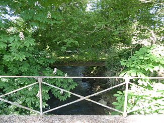
The Andelot in Broût-Vernet |
||
| Data | ||
| Water code | FR : K31-0300 | |
| location | France , Auvergne-Rhône-Alpes region | |
| River system | Loire | |
| Drain over | Allier → Loire → Atlantic Ocean | |
| source | in the municipality of Saint-Agoulin, 46 ° 3 ′ 9 ″ N , 3 ° 7 ′ 23 ″ E |
|
| Source height | approx. 540 m | |
| muzzle | in the municipality of Paray-sous-Briailles in the Allier coordinates: 46 ° 18 ′ 54 " N , 3 ° 22 ′ 13" E 46 ° 18 ′ 54 " N , 3 ° 22 ′ 13" E |
|
| Mouth height | approx. 230 m | |
| Height difference | approx. 310 m | |
| Bottom slope | approx. 6.2 ‰ | |
| length | 50 km | |
| Catchment area | 218 km² | |
| Reservoirs flowed through | Etang de Giat | |
| Small towns | Gannat | |
The Andelot is a river in France that runs in the Auvergne-Rhône-Alpes region . It rises in the municipality of Saint-Agoulin , drains generally in a north-easterly direction and flows into the Allier after 50 kilometers in the municipality of Paray-sous-Briailles , opposite Varennes-sur-Allier , in several branches of the river as a left tributary . On its way, the Andelot crosses the Puy-de-Dôme and Allier departments .
Places on the river
- Saint-Priest-d'Andelot
- Gannat
- Monteignet-sur-l'Andelot
- Escurolles
- Broût-Vernet
- Saint-Didier-la-Foret
- Paray-sous-Briailles
