Angangueo
| Angangueo | ||
|---|---|---|
|
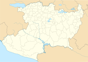
Coordinates: 19 ° 37 ′ N , 100 ° 17 ′ W Angangueo on the map of Michoacan
|
||
| Basic data | ||
| Country | Mexico | |
| State | Michoacan | |
| Municipio | Angangueo | |
| City foundation | 1617 | |
| Residents | 4601 (2010) | |
| - in the metropolitan area | 10,768 | |
| Detailed data | ||
| surface | 76.1 km 2 | |
| Population density | 60 people / km 2 | |
| height | 2600 m | |
| Website | ||
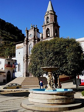
| Angangueo - the townscape | ||
| Angangueo - town center | ||
Minéral de Angangueo or short Angangueo is a Mexican town of about 5,000 inhabitants in the eastern part of the state of Michoacán ; the city is the administrative seat of the Municipio Angangueo with a total of about 12,000 inhabitants. Since 2012, the historic center of the city has been part of the Pueblos Mágicos .
Location and climate
Angangueo lies in the wooded mountains of the Sierra Madre Occidental at an altitude of about 2650 m ; the provincial capital Morelia is about 135 km to the west. The climate is temperate to warm; Rain (approx. 1020 mm / year) falls predominantly in the summer half-year.
Population development
| year | 2000 | 2005 | 2010 |
| Residents | 4,816 | 5,030 | 4,601 |
The vast majority of the population is of Indian descent; Mestizos are also numerous . The main language spoken is Spanish .
economy
Angangueo was a mining and administrative town until the early 20th century; after some misfortunes and because of the decline in earnings, the international mining companies closed the site. Since it was named Pueblo Mágico in 2012, inner-Mexican tourism has played a certain role in the economic survival of the remote town. There are numerous smaller cattle breeding farms (rancheros) in the villages around the village .
history
Angangueo was first visited by the Spanish under the leadership of Nuño Beltrán de Guzmán in 1530. Twenty years later, the Viceroy Antonio de Mendoza appointed former Captain General Gonzalo de Salazar to be the administrator of the area. The place was only officially founded in 1792; in 1831 he received the municipal status (municipio) . In 2010, heavy rains caused landslides and floods that almost led to the site being abandoned; numerous residents have been relocated, but some have since returned.
Attractions
- The neo-baroque church of San Simón Celador dates from the mid-19th century and is dedicated to the apostle Simon Zelotes . An approx. 20-step staircase leads to the portal. The single-nave interior of the church is dominated by baroque-classicist architecture.
- The one-tower Iglesia de la Concepción was built in the late 19th century in neo-Gothic style and is dedicated to the Immaculate Conception of Mary .
- The entire area around the village is one of the winter resting places of the monarch butterfly .


