
Armagh (District)
| Armagh District Ceantar Ard Mhacha |
|
|---|---|
  |
|
| geography | |
| Traditional county | County Armagh |
| surface | 671 km² |
| Administrative headquarters | Armagh |
| ISO 3166-2 | GB ARM |
| Demographics | |
| population | 60,147 (2012) |
| density | 90 people / km² |
| Denominations |
Protestants 43.0% Catholics 44.8% |
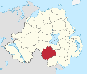
Armagh ( Irish : Ard Mhacha ) was one of the 26 Northern Irish districts that existed from 1973 to 2015. The district, whose area was in traditional County Armagh , was established in 1973. He was on the Northern Irish southern border and included the city of Armagh , which was also the administrative seat, with its surrounding area. On April 1, 2015, it went up in the new District of Armagh, Banbridge and Craigavon .
Armagh City and District Council
The election for Armagh City and District Council on May 11, 2011 resulted in the following:
| Political party | 2011 result | Change from 2005 | |||
|---|---|---|---|---|---|
| Seats | be right | Seats | be right | ||
| Ulster Unionist Party (UUP) | 6th | 27.6% | 1 | 4.9% | |
| Sinn Féin | 6th | 24.8% | 1 | 1.7% | |
| Social Democratic and Labor Party (SDLP) | 5 | 21.3% | −1 | 0.2% | |
| Democratic Unionist Party (DUP) | 4th | 21.1% | −2 | −8.4% | |
| Traditional Unionist Voice | 0 | 0.6% | 0 | 0.6% | |
| Independent | 1 | 4.5% | 1 | 1.1% | |
See also
Individual evidence
- ↑ Northern Ireland Population Estimates 2012 (XLS file)
- ↑ Northern Ireland Census 2011: Religion (administrative geographies)
- ^ Election result on BBC News (accessed July 26, 2011)
Antrim | Ards | Armagh | Ballymena | Ballymoney | Banbridge | Belfast | Carrickfergus | Castlereagh | Coleraine | Cookstown | Craigavon | Derry | Down | Dungannon and South Tyrone | Fermanagh | Larne | Limavady | Lisburn | Magherafelt | Moyle | Newry and Morne | Newtownabbey | North Down | Omagh | Strabane
Coordinates: 54 ° 20 ′ 58 " N , 6 ° 39 ′ 16" W.