Atalaya (Ucayali)
| Atalaya | ||
|---|---|---|
|
|
||
| Coordinates | 10 ° 44 ′ S , 73 ° 45 ′ W | |
| Basic data | ||
| Country | Peru | |
| Ucayali | ||
| province | Atalaya | |
| ISO 3166-2 | PE-UCA | |
| District | Raimondi | |
| height | 230 m | |
| Residents | 12,946 (2017) | |
| founding | May 29, 1928 | |
| politics | ||
| mayor | Adelmo Guerrero Enciso (2019-2022) |
|
Atalaya is the capital of the Atalaya Province in the Ucayali region in east-central Peru . The city is the administrative seat of the Raimondi district . The 2017 census counted 12,946 inhabitants, 10 years earlier the number of inhabitants was 9,103.
Geographical location
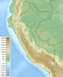
The city of Atalaya is located about 390 km east-northeast of the state capital Lima . It is located on the left bank of the Río Tambo , about 3 km south of its junction with the further east flowing Río Urubamba to the Río Ucayali . The city is located on the western edge of the Amazon lowlands at an altitude of about 230 m . To the west of the city rises the Sira Mountains , a ridge of the Peruvian Eastern Cordillera . The city lies on the border with the Satipo province ( Junín region ) further south . National Road 5S runs west from Atalaya to the city of Mazamari . The airport Tnte. Grail. Gerardo Pérez Pinedo Airport ( IATA airport code : AYX) is located northwest of the city center.
Individual evidence
- ↑ Peru: Ucayali Region - Provinces & Places . www.citypopulation.de. Retrieved January 13, 2020.

