Atmanaj
| Atmanaj | ||
| Атманай | ||

|
|
|
| Basic data | ||
|---|---|---|
| Oblast : | Zaporizhia Oblast | |
| Rajon : | Yakymivka district | |
| Height : | 7 m | |
| Area : | 1.47 km² | |
| Residents : | 992 (2001) | |
| Population density : | 675 inhabitants per km² | |
| Postcodes : | 72552 | |
| Area code : | +380 6131 | |
| Geographic location : | 46 ° 22 ' N , 35 ° 11' E | |
| KOATUU : | 2320380201 | |
| Administrative structure : | 4 villages | |
| Address: | вул. Матросова, буд. 5а 72552 с. Атманай |
|
| Website : | City council website | |
| Statistical information | ||
|
|
||
Atmanaj ( Ukrainian Атманай ; Russian Атманай Atmanai ) is a village in the extreme southwest of the Ukrainian Oblast of Zaporizhia with about 1000 inhabitants (2001).
The village, founded in 1841, is located at an altitude of 7 m on the Utlyuk Liman of the Sea of Azov north of the mouth of the Atmanaj River . The name of the river, near which the village was formed, derives from the words "ат" (horse) and "манаат" (inaccessible), due to the swampy bank that is inaccessible to horses.
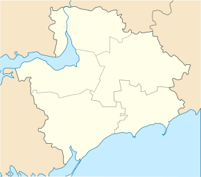
Atmanaj located in the southwest of Rajon Yakymivka , 14.5 kilometers west of the community center Kyryliwka , 47 km south of the Rajonzentrum Yakymivka and 190 km south of the Oblastzentrum Zaporizhia .
Until November 2017, the village was the administrative center of the district council of the same name , which also includes the villages of Wowtsche ( Вовче , ⊙ ) with about 10 inhabitants, Nowe ( Нове , ⊙ ) with about 220 inhabitants and Solone ( Солоне , ⊙ ) with about 290 inhabitants belonged. Since then the municipality belongs administratively to the settlement community of Kyrylivka .
Individual evidence
- ↑ a b c local website on the official website of the Verkhovna Rada ; accessed on November 18, 2019 (Ukrainian)
- ↑ Віктор Фоменко - Where does this name come from? Dbiporpetrovsk , 1969; accessed on November 18, 2019 (Ukrainian)

