Aubette (Meulan)
|
Aubette Aubette de Meulan |
||
|
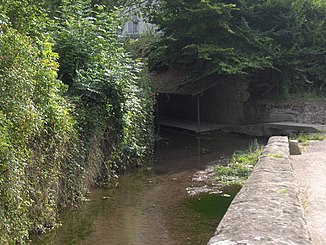
The Aubette and Wash House in Avernes |
||
| Data | ||
| Water code | FR : H3010600 | |
| location | France , Île-de-France region | |
| River system | His | |
| Drain over | Its → English Channel | |
| source | in the municipality of Guiry-en-Vexin 49 ° 6 ′ 58 ″ N , 1 ° 50 ′ 29 ″ E |
|
| Source height | approx. 105 m | |
| muzzle | on the municipal boundary of Meulan-en-Yvelines and Hadricourt in the Seine coordinates: 49 ° 0 '12 " N , 1 ° 54' 14" E 49 ° 0 '12 " N , 1 ° 54' 14" E |
|
| Mouth height | approx. 20 m | |
| Height difference | approx. 85 m | |
| Bottom slope | approx. 4.3 ‰ | |
| length | 20 km | |
| Catchment area | 147 km² | |
| Right tributaries | Montcient | |
| Small towns | Meulan-en-Yvelines | |
The Aubette (also: Aubette de Meulan ) is a river in France that runs in the Île-de-France regions. It rises under the name Ru de la Défonce in the Morval State Forest, in the municipality of Guiry-en-Vexin . The Aubette first drains in a south-easterly direction through the Vexin français Regional Nature Park , then swings to the south-west and flows after 20 kilometers at the municipal boundary of Meulan-en-Yvelines and Hadricourt as a right tributary into the Bras de Mézy tributary of the Seine . On its way, the Aubette crosses the Val-d'Oise and Yvelines departments .
Places on the river
(Order in flow direction)
Individual evidence
- ↑ Source geoportail.gouv.fr
- ↑ estuary geoportail.gouv.fr
- ↑ a b c The information on the length of the river is based on the information about the Aubette at SANDRE (French), accessed on February 2, 2013, rounded to full kilometers.
