Vexin français regional nature park

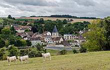
The Vexin français Regional Nature Park ( French: Parc naturel régional du Vexin français ) is located in the French departments of Val-d'Oise and Yvelines in the Île-de-France region . The core area of this natural park includes a limestone - plateau in the landscape Vexin , the west by the River Epte by the similarly titled Landscape Vexin normand is deferred.
Park management
The nature park was founded on May 9, 1995 and today covers an area of around 71,000 hectares. The park administration has its seat in the castle of Théméricourt ( 49 ° 5 ′ 11 " N , 1 ° 53 ′ 47" E ), where the "Maison du Parc "is located. 99 communities with a catchment area of around 98,000 inhabitants make up the park. The following other regional authorities are outside the nature park, but are associated with it as access points: Mantes-en-Yvelines , Limay , Issou , Meulan-en-Yvelines , Cergy-Pontoise municipalities .
Larger places in the park
- Auvers-sur-Oise
- Butry-sur-Oise
- Champagne-sur-Oise (outskirts)
- Ennery
- Gargenville (outskirts)
- Juziers (outskirts)
- Magny-en-Vexin
- Marines
- Parmain
- Vigny
landscape
The area of the Vexin français offers a variety of landscapes, such as limestone cliffs, wetlands and forests. This extensive limestone plateau with a dominant altitude of around 100 to 150 meters is bordered in the south by the Seine , in the east by the Oise , in the west by the Epte and in the north by Troësne and Esches . The plateau is also structured by valleys, such as those of the Viosne and the Sausseron , which drain to the Oise, or that of the Aubette , which runs to the Seine. In some places the plain is overlooked by wooded hills, which form their own biotope . The landscape is heavily used agriculturally , with mainly wheat , barley and rapeseed being grown in large crops. The aim of the nature park is to preserve the diversity of natural life forms and protected plant species that exist here and, if possible, to create habitats for their expansion and restoration.
Wetlands
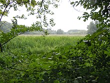
At the bottom of the valleys there are wet meadows , alkaline swamps and reed areas . They serve as water reservoirs and purification filters for this fragile biodiversity and play a major role in regulating the underground and above-ground water supply.
Numerous birds , insects and amphibians find refuge there. The breeding bird species observed are remarkable , such as the white wagtail , the reed warbler and the marsh warbler . The slopes offer moist and peat-rich soils, where a specific flora develops: sweet grasses , sedges , peat moss and king fern . Threatened by drainage and artificial reforestation, these valuable stocks have declined sharply since 1950, but are now the subject of development programs in the nature park.
Some interesting examples:
- Wetland of Rabuais in Arronville and Berville
- Frocourt wetland , in the municipality of Amenucourt
- Wetland near Montgeroult and Boissy-l'Aillerie
- Wetland at the Moulin de Noisement , near Chars
- Vallière reservoir near Santeuil
Wooded hills
Forest areas cover about 15% of the area of the park, which is a little over 10,000 hectares. The largest forested areas are on the hills of Arthies , Rosne ( Haravilliers parish ) and Marines . Other significant forest areas are the forest of La Tour du Lay near Nesles-la-Vallée and the forest of Laroche near La Roche-Guyon . The oaks are the basic element of forest vegetation, but ash , beech , maple , chestnut , bird cherry and some conifer species are also represented here. Chestnut and ash in particular were cultivated intensively until the 19th century.
Limestone cliffs
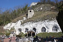
The flanks of the valleys that cut or delimit the Vexin français plateau often form steep rocky slopes . In addition, habitats with dry grass or meadows are formed where there is more fertile soil cover. Also fallow land are to be found here, where an agrarian use of the land was abandoned. Until the beginning of the 20th century, viticulture and fruit cultivation predominated here , but these left room for the development of wild species. This type of land use made it possible to maintain an open landscape; abandoning this practice in the course of the 20th century led to spontaneous plant growth, an overgrowth of the milieu and a reduction in animal and plant diversity.
One of the most important examples of this type of landscape is the Natura 2000 protected area Coteaux et boucles de la Seine (FR1100797), which slopes down to the river Seine with its distinctive river bends on the southwestern edge of the nature park .
Alluvial soils
When the Seine dug its river bed into the chalk cliffs of the slopes, it simultaneously deposited alluvial soils in the valley floor , which today form the lower and higher terraces in the loops of the Guernes and Moisson rivers . On the lowest terraces, which today correspond to the level of the river, trees, grasslands and ponds have formed. On the heights that dominate the meander between Saint-Martin-la-Garenne and Vétheuil , the Chesnay forest is the very last relic of an early alluvial terrace, which is now covered with light oak groves, where lime- loving and humus- seeking vegetation mix. These two meanders of the Seine are of great importance in the Ile-de-France for breeding and migratory birds . They are a preferred habitat of the triel , a rare bird species in Europe, as well as numerous species of migratory birds such as the hen harrier , the honey buzzard and all kinds of ducks . For a long time gravel pits were operated here to obtain building material for road construction ; today the goals are to preserve the diversity between wooded areas, grasslands and ponds.


