Avaré
| Avaré | |
|---|---|
|
Coordinates: 23 ° 6 ′ S , 48 ° 56 ′ W
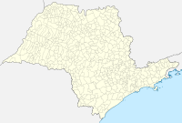
Avaré on the map of Sao Paulo
|
|
| Basic data | |
| Country | Brazil |
| State | São Paulo |
| City foundation | September 15, 1891 |
| Residents | 89,479 |
| Detailed data | |
| surface | 1213,055 |
| Population density | 74 people / km 2 |
| height | 766 m |
| Time zone | UTC −3 |
| City Presidency | Joselyr Benedito Costa Silvestre |
| Website | |
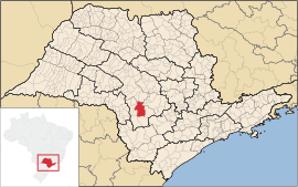
| Location of the municipality of Avaré in the state of São Paulo | |
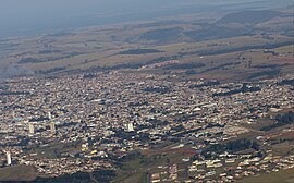
| Aerial view of Avaré | |
Avaré is a city in São Paulo , Brazil . It is located at a distance of 263 kilometers from the city of São Paulo and had almost 90,000 inhabitants in 2017. It is one of the centers for growing oranges. In addition to agriculture, tourism is an important economic factor.
population
The 2010 census showed a population of 82,934 people, a population density of 68.37 people per square kilometer. As of July 1, 2017, the population was estimated at 89,479 people.
economy
In 2015 Avaré generated a gross domestic product at current prices of 2.2 billion real . This corresponds to 25,023 real per person. Income is relatively unevenly distributed; in 2003, 22.3% of the population lived below the poverty line.
Agriculture
The main agricultural product of the municipality of Avaré is oranges . In 2016, 205,020 tonnes of oranges worth 116.9 million reals were harvested on 6,700 hectares. Other important crops are sugar cane (700,000 tons worth 44.8 million reals on 10,000 hectares), bananas (8,300 tons worth 20.7 million reals on 276 hectares), maize (30,090 tons worth 20 million reals on 5,950 hectares), beans (3,300 tonnes worth 16 million reals on 1,300 hectares) and soybeans (10,440 tonnes worth 12.5 million reals on 4,350 hectares). Fruits such as persimmons , guavas , peaches , mandarins , lemons , avocados and coffee are grown to a lesser extent .
In 2016 Avaré had a herd of 50,391 cattle, including 3,493 dairy cows. They delivered 6.8 million liters of milk worth 9.1 million reals. Avaré also had 1.45 million chickens; 868,000 laying hens produced 226 million eggs worth 48.6 million reals.
tourism
Avaré is one of the 29 municipalities in the state of São Paulo that meet the criteria for being allowed to call itself a health resort ( estância turística ). In the center of the tourist offer is the 400 square kilometer Represa de Jurumim reservoir , which is fed by the water of the Paranapanema . Most of the hotels as well as the water sports and recreational facilities are located there.
The EMAPA ( Exposição Municipal Agropecuária de Avaré , Agricultural and Livestock Fair of the City of Avaré) takes place in Avaré annually, where breeders and representatives of the livestock industry from all over Brazil meet. This fair has given the city the nickname National Capital of the Horse . The Feira Avareense de Música Popular Brasileira , which also takes place annually, aims to find young musicians, composers and interpreters of the Música Popular Brasileira .
traffic
The most important traffic artery in the region is the Rodovia Castelo Branco (BR-374 or SP-280), which runs in a west-east direction 10 kilometers north of the urban area of Avaré. Avaré is connected to this by the Rodovia João Mellão ( SP-255 ), this road also leads to the neighboring towns of Itaí and Pratânia . The Rodovia Salim Antonio Curiati ( SP-245 ) cuts through the Avarés territory from west to east and connects Avaré with Itatinga and Cerqueira César . The local aeroporto de Avaré-Arandu has very few flight movements.
In 2016, 59,222 vehicles were registered in Avaré, of which 34,000 were cars, 6600 small trucks, 1400 trucks and 14,200 motorcycles.
Web links
Individual evidence
- ↑ a b Conheça cidades e estados do Brasil - Avaré - Panorama. Instituto Brasileiro de Geografia e Estatística , accessed on April 3, 2018 .
- ↑ Conheça cidades e estados do Brasil - Avaré - Produto Interno Bruto dos Municipios. Instituto Brasileiro de Geografia e Estatística , accessed on April 3, 2018 .
- ↑ Conheça cidades e estados do Brasil - Avaré - Mapa de pobreza e desigualdade. Instituto Brasileiro de Geografia e Estatística , accessed on April 3, 2018 .
- ↑ Conheça cidades e estados do Brasil - Avaré - Produção Agrícola - Lavoura Permanente. Instituto Brasileiro de Geografia e Estatística , accessed on April 3, 2018 .
- ↑ Conheça cidades e estados do Brasil - Avaré - Pecuária. Instituto Brasileiro de Geografia e Estatística , accessed on April 3, 2018 .
- ↑ a b Avaré. Ecoviagem, accessed April 3, 2018 .
- ↑ Avaré. Viagem e Turismo, accessed April 3, 2018 .
- ↑ Conheça cidades e estados do Brasil - Avaré - Frota. Instituto Brasileiro de Geografia e Estatística , accessed on April 3, 2018 .


