Azemmour
Coordinates: 33 ° 17 ′ N , 8 ° 21 ′ W
Azemmour (from the mazirischen ⴰⵣⵎⵎⵓⵔ Azemmur , "olive"; arabic أزمور, DMG azamūr ), Portuguese Azamor, is a medium-sized city in the Casablanca-Settat region on the Atlantic coast of Morocco . Around 1500 the Portuguese built a trading post and soon a fortress. The economic importance of the place remained in the following centuries and until today behind the neighboring port city of El Jadida . There are no outstanding sights, but the old town remained intact in its external form.
location
Azemmour is located about 80 kilometers southwest of Casablanca and 16 kilometers northeast of El Jadida on a branch line running parallel to the coast north of the Autobahn 5 (Autoroute de l'Atlantique) . Unlike El Jadida , the town in the province of El Jadida has no direct port, but is located two kilometers from the sea on a rocky plateau on the left bank of the Oum er-Rbia . This longest water-bearing river in the country has its source in the mountains of the Middle Atlas between Azrou and Khénifra . Inland from the city there is a bridge over the river. The agricultural fields of the surrounding fertile Doukkala plain form the economic basis of the city.
history
Azemmour's early history may begin in Carthaginian times. Azemmour appears to have been a center of Islamic scholarship in the 12th century. The scholar Moulay Bouchaib Erredad (around 1076–1166) attracted students from far away, including Lalla Aicha Bahria, who had traveled from Baghdad . Both are venerated as saints today.
The rule of the Almohads ended with the capture of Marrakech by the Merinids in 1269. The Almohad caliph al-Murtada, who fled to Azemmour in 1266, was sentenced to death in 1267 at the behest of the last Sultan Abu Dabis (Abou Dabbou, ruled 1266-1269). Azemmour was also mentioned at the end of the 14th century during the rule of the Merinids. The subsequent Berber dynasty of the Wattasids fought in vain in 1471 against the conquest of Tangier by the Portuguese, who initially believed they were on a crusader mission. Azemmour was relatively independent during this period.
In 1486 Portuguese merchants set up a trading post in Azemmour to buy fabrics, wool, horses, fish and grain, which they exchanged for gold and slaves in the European competition for trade on the southern Black African coast. The first ships reached the Senegal River in the middle of the 15th century . When the Portuguese began to no longer pay for their goods in the hinterland of the Moroccan stations (presidios) , but instead declared the locals to be vassals and demanded tribute payments, there were uprisings among the population and attacks on the Portuguese branches. The weakened Wattasids allowed the Portuguese to completely occupy the city of Agadir in 1505 , Safi in 1508 and Azemmour in 1513. In August 1513, militarily superior Portuguese troops coming from El Jadida (then Mazagan) took over the city. A first attempt at conquest in 1508 had failed. To protect against further attacks, they surrounded the city with a fortification wall. Azemmour was paid tribute to King Manuel I. A raid carried out in 1515 by the governors D. Pedro de Sousa von Azemmour and Nuño Fernandes de Ataide from Safi to Marrakech aimed to make the local ruler Mulai al-Nasir a vassal of Portugal. The Portuguese had underestimated the willingness of the inhabitants to fight in the defense of their city and suffered defeat.
In 1541 the Portuguese had to withdraw from Azemmour and Safi, once because of economic difficulties in their homeland and because they were threatened by Muhammad al-Sheikh , who had gained the upper hand against the Wattasids in the south with the conquest of Agadir in the same year. Ash-Sheikh became the first Saadian sultan to rule all of Morocco in 1544. After a few years of rule, the Portuguese left behind a fortress and a city wall, large parts of which are still preserved.
At the end of the 16th century, a Muhammad al-Ayyashi, a member of the Arab tribe of the Banu Malik in the Gharb region, came to Salé to pursue Islamic studies there. His teacher was Sidi Abdullah. According to legend, some tribal leaders brought a horse to Sidi Abdullah as a gift. He called his best pupil and instructed him to continue his studies outside in life and to ride the horse to Azemmour. After a few years, al-Ayyashi had become governor of Azemmour on behalf of the Saadian sultan Zaydan. From his position he attacked the Spaniards at El Jadida and, as he gathered more and more warriors around him, became a dangerous rival for the Sultan. At least the Spaniards were able to convince the sultan of this, who in response sent an army from Marrakech in 1614 to destroy al-Ayyashi in Azemmour. He managed to escape by fleeing and went back to Salé with his people. There he worked along the coast until his death in 1641 as a pirate and holy warrior fighting the Spaniards and Portuguese.
From at least the 16th century until the middle of the 20th century there was a significant Jewish minority in Azemmour. In the 1940s, the Jewish saint Rabbi Abraham Mul Annes (Abraham Moul Niss) of Azemmour gained great popularity across the country. His grave is said to be in the courtyard of a private house in the old town. He was revered by Jews and Muslims alike.
The most famous inhabitant of the city was called Estevanico by his Spanish name , in Morocco he is called al-Zemmouri , "the man from Azemmour". He is the first known African to go on a ship expedition to the New World in the 16th century . He started in June 1527 as a Portuguese slave from Spain with the fleet of five caravels of the Pánfilo de Narváez , which reached Florida a year later .
Cityscape
In the 2004 census, the city had 36,722 inhabitants, for 2011 40,560 inhabitants were calculated.
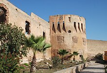
The old town is on the west side of the river, which does not take the next north-west route from the city to the sea, but rather flows three kilometers north to the confluence. The central triangular square of the city (Place Mohammed V) , where the avenue of the same name coming from the southwest ends, belongs to the small business center of the new town and is framed by two other streets. The avenue Zirkouni east of the square runs next to the city wall, which forms a long rectangle around the old town. To the east of the old town, the wall stretches along a small plateau above the river bank. Some parts of the Portuguese city wall are sloping on the outside, there are round towers with large rectangular window openings for cannons, while others have small recessed loopholes that expand downwards and were designed for muzzle-loaders and crossbows . Only the tower remains of the former Portuguese powder magazine (Dar el-Baroud) .
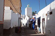
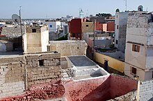
The old town is divided into three parts. In the south are the former Arab residential area ( Medina ) and the (locked) Kasbah , where the administration was located. In the north, the Jewish Mellah can be recognized by the small former synagogue , which is located near the shore and is named after Rabbi Abraham Moul Niss. Some of the houses in the narrow streets date from the Christian era, the special features are in the details. The remains of Gothic windows have been preserved on the powder house, and some door frames, balconies and lunettes on the house facades also have a European tradition. Few tourists visit the old town compared to El Jadida. Two of the old, white-painted houses have been converted into hotels of a higher standard. Some private houses have also been carefully restored, but the condition of most of the houses shows the lack of financial strength of the residents. Business only takes place outside the walls.
A much larger part of the city area is made up of the new residential districts planned after independence, which expand to the west and south according to a rectangular street pattern. From the central square a road leads two kilometers to the district of El Haouzia. Several holiday complexes for Moroccan vacationers have been built on the wide sandy beach. It is 1.5 kilometers along the beach to the northeast to the mouth of the Oum er-Rbia. There you will find the Qubba (mausoleum) of Sidi Ouadouad and on the opposite bank of the river the Qubba of the female saint Lalla Aicha Bahria. On public holidays, boats run to their place of pilgrimage on the beach.
Moulay Bouchaib Erredad is the patron saint of Azemmour and known far beyond the city limits. An annual pilgrimage festival ( Moussem ) is organized for him ; his Qubba is located outside the city wall in the southeast of the medina, at the end of Rue Bouchaib. The marabout is especially revered by women who want to have children, who expect the Islamic power of blessing ( baraka ) when visiting its mausoleum .
literature
- Jamil M. Abun-Nasr: A history of the Maghrib in the Islamic period. Cambridge University Press, Cambridge 1987
- Ingeborg Lehmann, Rita Henss: Morocco. Karl Baedeker, Ostfildern 2009, p. 234f, ISBN 978-3-8297-1156-2
Web links
Individual evidence
- ↑ Thomas K. Park, Aomar Boum: Historical Dictionary of Morocco. Library of Congress. 2nd ed., Scarecrow Press, Lanham 2006, p. 47
- ↑ Jamil M. Abun-Nasr, p. 106
- ↑ Benson A. Mojuetan: History and Under Development in Morocco: The structural roots of conjuncture. (Monographs of the International African Institute) Lit-Verlag, Münster 1997, p. 58f
- ↑ Jamil M. Abun-Nasr, p. 211
- ^ Peter Lamborn Wilson : Pirate Utopias: Moorish Corsairs & European Renegadoes. Autonomedia, Williamsburg (Brooklyn) 2004, pp. 77f
- ↑ Jamil M. Abun-Nasr, pp. 221f
- ^ Issachar Ben-Ami: Saint Veneration Among the Jews in Morocco. (Raphael Patai Series in Jewish Folklore and Anthropology). Wayne State University Press, Detroit 1998, p. 206
- ↑ Kitty Morse: Esteban of Azemmour and His New World Adventures. ( Memento of the original from August 7, 2011 in the Internet Archive ) Info: The archive link was automatically inserted and not yet checked. Please check the original and archive link according to the instructions and then remove this notice. Saudi Aramco World, March / April 2002, pp. 2-9
- ↑ Archived copy ( Memento of the original dated December 29, 2011 in the Internet Archive ) Info: The archive link was automatically inserted and not yet checked. Please check the original and archive link according to the instructions and then remove this notice. World Gazetteer
- ^ Mounir Siraj: La baraka du saint Moulay Bouchaïb Erredad. ( Page no longer available , search in web archives ) Info: The link was automatically marked as defective. Please check the link according to the instructions and then remove this notice. Aujourd'hui Le Maroc, September 3, 2008


