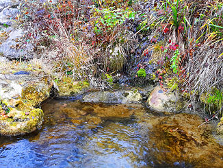
Bättelweidbach
|
Bättelweidbach Weidholzbach |
||
|
Bättelweidbach between Birmensdorf (left) and Stallikon (right) |
||
| Data | ||
| Water code | CH : ZH100345 | |
| location | Switzerland | |
| River system | Rhine | |
| Drain over | Reppisch → Limmat → Aare → Rhine → North Sea | |
| source | at Bättelweid near Diebis , Stallikon 47 ° 21 ′ 9 ″ N , 8 ° 28 ′ 28 ″ E |
|
| Source height | approx. 618 m above sea level M. | |
| muzzle | at Güetli in the Reppisch coordinates: 47 ° 21 '1 " N , 8 ° 28' 9" E ; CH1903: 677 856 / 244895 47 ° 21 '1 " N , 8 ° 28' 9" O |
|
| Mouth height | 502 m above sea level M. | |
| Height difference | approx. 116 m | |
| Bottom slope | approx. 17% | |
| length | 670 m | |
| Left tributaries | Lattenbächli | |
| Communities | Stallikon , Birmensdorf | |
|
The Bättelweidbach flows into the Reppisch |
||
The Bättelweidbach (also Weidholzbach ) is a 670 meter long right tributary of the Reppisch in the communities of Stallikon and Birmensdorf in the canton of Zurich .
It drains a small area at the north-western end of the Albis chain and runs in its lower reaches along the municipal boundary and at the same time the district boundary between the Dietikon district in the west and the Affoltern district in the east, but just in the latter.
geography
course
The stream rises at about 618 m above sea level. M. below the Chatzenstricks in the Bättelweid corridor , which is now almost completely wooded. The source is east of the Uetliberg and below Ringlikon . After a short stream to the southwest through the forest, it crosses under the Schwandenstrasse between Ringlikon and Stallikon. It flows through the Grossacher straightened and accompanied by patchy, dense bushes, before it crosses Landikerstrasse , which connects Landikon with Stallikon, and reaches the Mülimatt .
The stream now flows to the northwest and briefly follows the road, where it is now always accompanied by thick bushes. He maintains this course until the confluence of the somewhat longer Lattenbächlis from the right. From here it forms the municipal boundary and flows back to the southwest between Latten in the west and Mülimatt in the east. Finally the Bättelweidbach flows out at Güetli at 502 m above sea level. M. from the right and northeast into the middle reaches of the Reppisch.
Tributaries
The direct and indirect tributaries downstream
-
Lattenbächli ( right ), 0.5 km
- Bölbächli ( right ), 0.1 km
- Chleibtelbächli ( left ), 0.3 km
See also
Web links
- Course of the Bättelweidbach on GIS Zurich
- Course of the Bättelweidbach on the geoserver of the Swiss federal administration
swell
Individual evidence
- ↑ a b c individual records of the geographic information system of the canton of Zurich
- ↑ Geoserver of the Swiss Federal Administration ( information )
- ↑ Lengths rounded to one decimal place

