Bílá Opava
|
Bílá Opava White Oppa |
||
| Data | ||
| location | Moravskoslezský kraj , Czech Republic | |
| River system | Or | |
| Drain over | Opava → Or → Stettiner Haff | |
| source | south of Praděd in the Jeseníky Mountains 50 ° 4 ′ 33 ″ N , 17 ° 13 ′ 50 ″ E |
|
| Source height | 1280 m nm | |
| muzzle | at Železná with the Střední Opava to Opava Coordinates: 50 ° 7 ′ 28 ″ N , 17 ° 22 ′ 0 ″ E 50 ° 7 ′ 28 ″ N , 17 ° 22 ′ 0 ″ E |
|
| Mouth height | 544 m nm | |
| Height difference | 736 m | |
| Bottom slope | 56 ‰ | |
| length | 13.1 km | |
| Catchment area | 27.54 km² | |
| Drain |
MQ |
370 l / s |
| Residents in the catchment area | 527 | |
The Bílá Opava (German White Oppa ) is the right source river of the Opava in the Czech Republic.
course
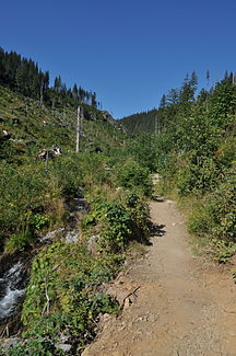
The Bílá Opava rises on the saddle between the Praděd (1491 m) and the Petrovy Kameny (1438 m) from two source streams. The left is the Pradědský potok, the source of which is at the southern foot of the Praděd near Chata Barborka. The right source stream, the Ovčárenský potok, rises east of the Petrovy Kameny at the Chata Ovčárna. On its way to the east, the Bílá Opava forms a deep gorge in the gneiss slopes of the Praděd and the Vysoká hole on its upper reaches to Karlova Studánka for two and a half kilometers . In it the brook overcomes a height difference of 16.4 meters on a 40 m long section with several cascades and waterfalls. The Velký vodopád waterfall has a height of 7.9 meters.
The further course leads through a notched valley, in which the Ludvíkov municipality extends, to the northeast. After 13.1 kilometers the Bílá Opava unites with the Střední Opava between Železná and Vrbno pod Pradědem to the Opava . To the west, above the confluence, rises the Zámecká hora (854 m) with the remains of the Fürstenwalde Castle .
nature
The entire course of the river lies within the Jeseníky Protected Landscape Area, the gorge on the upper reaches is part of the Praděd National Nature Reserve.
A 10.5-kilometer nature trail was set up in 1963 between Karlova Studánka and Chata Barborka.
Web links
- http://www.pod.cz/plan-oblasti-povodi-Odry/inf_listy/prilohy/023_RL_VU.pdf
- http://www.jesenik.net/index.php?obl=1&kat=11&sluz=81&pol=2809
- http://www.ejeseniky.com/turistika/naucne-stezky/bila-opava
