
Bąków (Strumień)
| Bąków | |||
|---|---|---|---|
_COA.svg)
|
|
||
| Basic data | |||
| State : | Poland | ||
| Voivodeship : | Silesia | ||
| Powiat : | Cieszyn | ||
| Gmina : | Strumień | ||
| Area : | 5.91 km² | ||
| Geographic location : | 49 ° 54 ' N , 18 ° 44' E | ||
| Residents : | 1477 (2010) | ||
| Postal code : | 43-246 | ||
| Telephone code : | (+48) 33 | ||
| License plate : | SCI | ||

Bąków ( German Bonkau ) is a village with a Schulzenamt of the municipality Strumień in the powiat Cieszyński of the Silesian Voivodeship , Poland .
geography
Bąków is located in the Auschwitz Basin ( Kotlina Oświęcimska ), about 25 km northwest of Bielsko-Biała and 45 km southwest of Katowice in the powiat (district) Cieszyn.
The village has an area of 591 ha .
Neighboring towns are Zbytków and the city of Strumień in the north, Zabłocie in the west, Pruchna and Drogomyśl in the south, Pielgrzymowice , Golasowice and Jarząbkowice in the north-west.
history
The village is located in the Olsa area (also Teschener Silesia , Polish Śląsk Cieszyński ).
Bąków absorbed an older village, Rychułd ( German Rychuld ), first mentioned in 1416 as the village of Ober Reicholtowacz . Bąków was first mentioned in 1536. The name is derived from the first name of the owner Bąk .
Politically, the village belonged to the Duchy of Teschen , the feudal lordship of the Kingdom of Bohemia , and from 1526 it belonged to the Habsburg Monarchy .
After the abolition of patrimonial Bąków and Rychułd were from 1850 a municipality in Austrian Silesia , Bielitz district and judicial district Schwarzwasser. In the years 1880 to 1910 the municipality had about 420 inhabitants (Bąków about 250, Rychułd about 175), the majority were Polish-speaking (between 98.7% in 1880 and 89% in 1910) and German-speaking (11% in 1910 ). In 1910, 50% were Roman Catholic, 48% were Protestant, there were nine (2%) Jews.
In 1920, after the collapse of the Austro-Hungarian monarchy and the end of the Polish-Czechoslovak border war , Bąków became part of Poland. This was only interrupted by the occupation of Poland by the Wehrmacht in World War II .
From 1975 to 1998 Bąków belonged to the Bielsko-Biała Voivodeship .
religion
The Catholic parish (established in 1990) belongs to the Bielsko-Żywiec diocese , Strumień deanery. The evangelical branch church belongs to the parish Drogomyśl, diocese of Cieszyn .

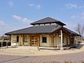
Catholic Church
Evangelical branch church


Web links
Individual evidence
- ↑ a b c Robert Mrózek: Nazwy miejscowe dawnego Śląska Cieszyńskiego . Uniwersytet Śląski w Katowicach , 1984, ISSN 0208-6336 , p. 37, 154-155 (Polish).
- ↑ Marcin Żerański: Śląsk Cieszyński od Bielsko-Białej do Ostrawy. Przewodnik turystyczny . Pracownia na Pastwiskach, Cieszyn 2012, ISBN 978-83-933109-3-7 , p. 264 (Polish).
- ↑ Gmina Strumień: STUDIUM UWARUNKOWAŃ I KIERUNKÓW ZAGOSPODAROWANIA PRZESTRZENNEGO GMINY STRUMIEŃ ( pl ) In: www.strumien.bip.net.pl . 2007. Retrieved December 7, 2010.
- ^ Idzi Panic: Śląsk Cieszyński w średniowieczu (do 1528) . Starostwo Powiatowe w Cieszynie, Cieszyn 2010, ISBN 978-83-926929-3-5 , p. 306 (Polish).
- ↑ Śląsk Cieszyński w początkach czasów nowożytnych (1528-1653) . Starostwo Powiatowe, Cieszyn 2011, ISBN 978-83-926929-5-9 , pp. 163 .
- ↑ Kazimierz Piątkowski: Stosunki narodowościowe w Księstwie Cieszyńskiem . Macierz Szkolna Księstwa Cieszyńskiego, Cieszyn 1918, p. 261, 280 (Polish, opole.pl ).
- ↑ Ludwig Patryn (ed): The results of the census of December 31, 1910 in Silesia , Opava 1912.
- ↑ Dz.U. 1975 no 17 poz. 92 (Polish) (PDF file; 783 kB).