Badschal Mountains
| Badschal Mountains | ||
|---|---|---|
| Highest peak | Gora Korol ( 2269 m ) | |
| location | Khabarovsk region ( Russia ) | |
|
|
||
| Coordinates | 50 ° 34 ' N , 134 ° 36' E | |
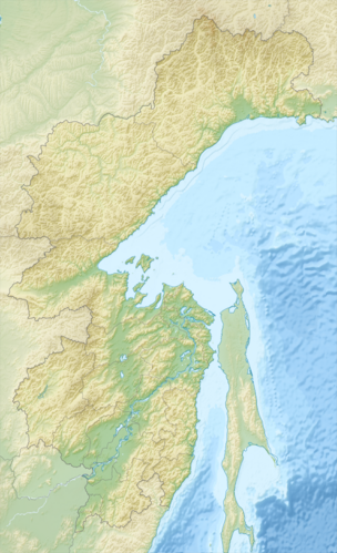
The Badschal Mountains ( Russian Баджа́льский хребет ) is a mountain range in the Khabarovsk region in the Far East of Russia .
The 220 km long mountain range runs in a southwest-northeast direction west of the city of Komsomolsk am Amur between the lower reaches of the Amur in the east and its left tributary Amgun in the west. The Badschal Mountains reach with the Gora Korol (гора Король) a maximum height of 2269 m . Until the beginning of 2016, the Ulun (гора Улун) was entered on the topographic maps as the highest mountain in the chain at 2221 meters. In the southwest it turns into the Bureja Mountains .
In the Badschal Mountains, mica slate , sandstone and andesite - basalts and granite occur.
Larch forests grow in lower elevations . At higher altitudes there are berry bushes and lichens .
Individual evidence
- ↑ The geographical volume of the Great Soviet Encyclopedia gave a height of 2512 meters for the Ulun. (Moscow 1983. p. 46.) while the 3rd edition of the encyclopedia still mentioned a mountain height of 2640 meters (3rd edition, 1969–1978).
- ↑ dvnovosti.ru: Комсомольские туристы совершили открытие, заново определив максимальную высоту Бадебала. (Russian; from February 16, 2016)
- ↑ Они взяли карты в руки и… пошли на Короля. (Russian, ascent of the Korol) accessed on November 6, 2018
- ↑ a b Article Badschal Mountains in the Great Soviet Encyclopedia (BSE) , 3rd edition 1969–1978 (Russian)
