
Bath hut
| Bath hut | ||
|---|---|---|
 Bath hut |
||
| location | Alp Tuma, above Lake Toma , Oberalppass region ; Canton of Graubünden , Switzerland ; Valley location: Tujetsch | |
| Mountain range | Gotthard Group | |
| Geographical location: | 694 166 / 165 774 | |
| Altitude | 2502 m above sea level M. | |
|
||
| owner | SAC section Manegg | |
| Built | 1967 | |
| Construction type | hut | |
| Usual opening times | July to September | |
| accommodation | 0 beds, 20 camps | |
| Web link | Bath hut | |
| Hut directory | SAC | |

The Badushütte is a mountain hut belonging to the SAC Manegg section in the Swiss canton of Graubünden .
It is located on Alp Tuma at 2502 m in the Gotthard Group north of Badus ( 2928 m ). The hut is located on the eastern foothills of Fil Tuma ( 2608 m ), a ridge that drops to the southeast above the Martschallücke ( 2684 m ) at P. 2742 from the ridge between Rossbodenstock ( 2837 m ) and Pazolastock ( 2739 m ).
From the hut the view opens to the south over a wide basin between Fil Tuma, Rossbodenstock, Parlet ( 2766 m ), Piz Tuma ( 2784 m ) and Badus. In the valley floor southeast below the hut is the Tomasee ( 2344 m ), which is considered to be the source of the Rhine .
The hut offers 20 beds and does not have a public winter room.
In 1965, the Piz Lucendro section, from which the Manegg section split off in 1970, bought a former military hut on Alp Tuma for 50 francs. A new building was constructed in 1966/67.
Accesses
Oberalp Pass via Pazolastock
- Starting point: Oberalppass ( 2042.8 m )
- Route: Pazolastock ( 2739 m ), Martschallücke ( 2684 m )
- Difficulty: Experienced mountain hiker
- Time required: 2½ hours
Oberalp Pass via Val Maighels
- Starting point: Oberalppass ( 2042.8 m )
- Route: Trutg Nuschalas, Tomasee
- Difficulty: mountain hikers
- Time required: 2 hours
Tschamut
- Starting point: Tschamut ( 1645 m )
- Route: Crest Darvun, Plidutscha, Tomasee
- Difficulty: mountain hikers
- Time required: 3 hours
Andermatt
- Starting point: Andermatt ( 1436 m )
- Route: Schöni, Pazolastock ( 2739 m ), Martschallücke ( 2684 m )
- Difficulty: Experienced mountain hiker
- Time required: 6½ hours
Adjacent huts
- Maighelshütte via Tomasee in approx. 1½ hours
- Cadlimohütte via Maighelshütte , Bornengopass in approx. 5 hours
- Capanna Cadagno via Cadlimohütte in approx. 7½ hours
- Vermigelhütte via Maighelshütte , Maighels- or Lolenpass in approx. 4 hours
Tours
The area around the hut offers a variety of opportunities for hiking, alpine, climbing and bike tours (Oberalp and Maighelspass) in summer and ski tours in winter:
- Piz Tagliola 2708 m above sea level M. , Badus (Six Madun) 2928 m above sea level M. , Piz Tuma 2784 m above sea level. M. , Parlet 2767 m above sea level. M. , Rossbodenstock 2836 m above sea level. M. , Pazolastock 2740 m above sea level M.
- Maighelspass 2421 m above sea level M. , Lolenpass (Tagliola Pass) 2399 m above sea level. M. , Bornengopass 2631 m above sea level M.
- Lake Toma (Lai da Tuma) 2345 m above sea level M. ( source of the Rhine )
- Climbing garden, 15 minutes above the hut (7 routes, up to 20 m high, degrees 3 to 6)
- Lai da Curnera reservoir
- Piogn Crap (stone bridge), Lai Urlaun
- Maighels Glacier
photos


Badushütte from below Piz Tuma
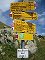
Signpost at the Badushütte


literature
- Sheet 1232 Oberalppass, national map 1: 25,000 (valley location Andermatt)
- Sheet 256 Disentis, national map 1: 50,000
- Remo Kundert, Marco Volken: Huts in the Swiss Alps. 1st edition. Verlag des SAC, 1998, ISBN 3-85902-177-X , p. 256.
See also
Web links
Individual evidence
- ↑ a b SwissTopo (maps of Switzerland)
- ^ Hut homepage
- ^ Piz Lucendro: SAC Manegg - history. In: sac-manegg.ch. Retrieved March 18, 2020 .
- ↑ Georg Epp: 100 year anniversary is imminent. In: Lucerne newspaper. August 14, 2018, accessed March 18, 2020 .
- ^ History. In: badushuette.ch. April 26, 2017, accessed March 18, 2020 .