Baranoa
| Baranoa | ||
|---|---|---|
|
Coordinates: 10 ° 48 ′ N , 74 ° 55 ′ W Baranoa on the map of Colombia
|
||
|
Location of the municipality of Baranoa on the map of Atlántico
|
||
| Basic data | ||
| Country | Colombia | |
| Department | Atlántico | |
| City foundation | 1543 | |
| Residents | 60,092 (2019) | |
| City insignia | ||
| Detailed data | ||
| surface | 127 km 2 | |
| Population density | 473 inhabitants / km 2 | |
| height | 118 m | |
| Time zone | UTC -5 | |
| City Presidency | Lázaro Rafael Escalante Estrada (2016-2019) | |
| Website | ||
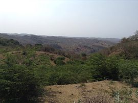
| Landscape near Baranoa | ||
Baranoa is a municipality ( municipio ) in the department of Atlántico in the north of Colombia .
geography
Baranoa is located in the center of Atlántico , 22 km south of Barranquilla and has an average temperature of 27 ° C. The commune creates a link between the metropolitan area of Barranquilla and the agricultural zone of the department. The municipality borders Galapa and Turbará in the north, Sabanalarga in the south , Malambo and Polonuevo in the east and Juan de Acosta and Usiacurí in the west .
population
The municipality of Baranoa has 60,092 inhabitants, of which 50,572 live in the urban part (cabecera municipal) of the municipality (as of 2019).
history
Even before the arrival of the Spaniards, there was an indigenous settlement on the site of today's Baranoa. The area was conquered by Pedro de Heredia in 1533 . Ten years later the place was settled by Spaniards, incorporated into the encomienda system and called Santa Ana de Baranoa en la Costa Caribe , where Baranoa was the name of a regional tree species and was the only part of the original name. The indigenous families living in Baranoa were relocated to Galapa in 1745 by the Spanish viceroy Sebastián Eslava . Since 1800 Baranoa had the status of a parish and since 1856 the status of a parish in today's sense. The place suffered from the civil wars of the 19th century and a large part of Baranoa burned down during a battle between liberal and conservative forces in 1895.
economy
The most important industries in Baranoa are agriculture , especially the cultivation of cassava , corn , pigeon peas , watermelon and plums , as well as cattle and poultry production .
Web links
- Alcaldía de Baranoa - Atlántico. Alcaldía de Baranoa - Atlántico, accessed on May 15, 2019 (Spanish, website of the municipality of Baranoa).
Individual evidence
- ^ Información del municipio. Alcaldía de Baranoa - Atlántico, accessed on May 15, 2019 (Spanish, information on the geography of the municipality).
- ↑ ESTIMACIONES DE POBLACIÓN 1985 - 2005 Y PROYECCIONES DE POBLACIÓN 2005 - 2020 TOTAL DEPARTAMENTAL POR ÁREA. (Excel; 1.72 MB) DANE, May 11, 2011, accessed on May 15, 2019 (Spanish, extrapolation of the population of Colombia).
- ↑ Pasado, presente y futuro. Alcaldía de Baranoa - Atlántico, accessed on May 15, 2019 (Spanish, information on the history of the municipality).
- ↑ Economía. Alcaldía de Baranoa - Atlántico, accessed on May 15, 2019 (Spanish, information on the municipality's economy).


