
Beara Peninsula
| Beara Peninsula | ||
 Location of the Beara Peninsula |
||
| Geographical location | ||
|
||
| Coordinates | 51 ° 44 ′ N , 9 ° 50 ′ W | |
| Waters 1 | Atlantic Ocean | |
| length | 50 km | |
| width | 15 km | |
 The Beara Peninsula as seen from Healy Pass |
||

The Beara Peninsula ( Irish Béarra , also called Caha Peninsula) is located in the southwest of Ireland south of the Iveragh Peninsula (with the Ring of Kerry ) and belongs to the smaller part of County Kerry , while the larger part of County Cork . It is west of the pass road that connects the places Kenmare in County Kerry and Glengarriff in County Cork.
The peninsula is mountainous with only a few forests, about 50 km long and 15 km wide at the beginning. It tapers in a wedge shape. At its end is Dursey Island . Bere Island is located south of the Beara Peninsula near Castletownbere , the largest town on the peninsula . The port of the city is protected from the sea by the offshore island. Castletownberehaven is the second largest natural harbor in the world (after Sydney in Australia). For a long time it was of great strategic importance. There are numerous military fortifications from historical times on Bere Island.
In terms of its tourist attractiveness, the Beara Peninsula does not differ much from the northern peninsulas. The coastal ring road, the Ring of Beara , is closed to coaches over 2.8 t and mobile homes because of the narrow and winding road, so it is less developed for tourists.

Between Lauragh and Adrigole, the mountains are crossed by a narrow road over Healy Pass. The view overlooks the valley with Glenmore Lake, around which rhododendron bushes bloom in May.
The peninsula is named after the old Irish goddess of fertility Beara (Caillech Bhéarra) and has a collection of prehistoric monuments in addition to the rock of Kilcatherine on the north coast, which is dedicated to the goddess. The Christianization of Beara took place through the "nun of Beara". There are also sources that say the name Beara came from the Spanish princess Bera, who was the wife of the first king of Munster .
Cork and Kerry offer a concentration of:
- over 600 menhirs
- 200 short rows of stones with up to six stones
- 87 Boulder Burials (barrows)
- 18 Wedge Tombs (Keil graves)
- many stone circles .
The number of stone circles is obvious. Among them stand out those of Ardgroom , Derrintaggart West, Dromroe, Kenmare and Uragh . Wedge Tombs (e.g. Killough West and Kilmacowen ) and Boulder Burials are representatives of the megalithic building types. An assortment of bullaun and ogham stones as well as the type of ring fort (Teernahillane) are also represented here. Last but not least, the holy sources obligatory for Ireland are numerous. The copper and the associated malachite mining between Allihies and Castletownbere has a tradition of several thousand years.
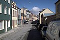
Colorful houses on the main street of Castletownbere

The Square - The center of Castletownbere


See also
- Ardgroom
- Ballycrovane
- Dingle Peninsula
- Iveragh Peninsula
- Ring of Beara
- Uragh North stone circle
- Row of stones from Eightercua
literature
- Walter L. Brenneman Jr., Mary G. Brenneman: Crossing the circle at the holy wells of Ireland . University Press of Virginia, Charlottesville / London, 1995, ISBN 0-8139-1548-1 .
- Peter Harbison , Edelgard Soergel-Harbison: Pre-christian Ireland: from the first settlers to the early Celts . Thames and Hudson, London 1988, ISBN 0-500-27809-1 .
- Elizabeth Healy: In search of Ireland's holy wells . Wolfhound Press, 2002, ISBN 0-86327-865-5
- Cornelius J. Murphy: The prehistoric Archeology of the Beara Peninsula . Beara Historical Society Castletownbere 2014. At the same time: Dissertation at the Department of Archeology of University College Cork of the National University of Ireland , 1997
Individual evidence
- ^ History of the O'Sullivans
- ↑ Reference in the catalog of University College Dublin , accessed on August 31, 2015.