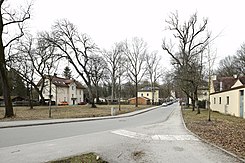
Benediktbeuerer Strasse
| Benediktbeuerer Strasse | |
|---|---|
| Street in Munich | |
| Basic data | |
| State capital | Munich |
| Borough | Thalkirchen-Obersendling-Forstenried-Fürstenried-Solln |
| Created | around 1870 |
| Hist. Names | Mühlstrasse |
| Name received | 1901 |
| Connecting roads | Maria-Einsiedel-Straße, Zentralländstraße |
| Numbering system | Orientation numbering |
| U- and S-Bahn station | Munich Karlsplatz train station |
| use | |
| User groups | Pedestrian traffic , bicycle traffic , car traffic , public transport |
| Technical specifications | |
| Street length | 275 m |
The Benediktbeuerer street is a street in the Munich area Thalkirchen .
location
The street is located in the Maria Einsiedel district of Thalkirchen at the foot of the western bank of the Isar. It begins on the Zentralländstraße ( Lage ) at the point where the Zentrallände overflows into the Mühlbach , and extends to Maria-Einsiedel-Straße ( Lage ). It leads across the Maria-Einsiedelbach that runs across it . To the north of the road is the Maria Einsiedel natural swimming pool ( Lage ), to the south of it is an allotment garden ( Lage ).
history
Benediktbeuerer Strasse was laid out in the third quarter of the 19th century when the Isar floodplains were turned into a landscape park. Used to be called Mill Road after the next to the present Asam-Schlössl located at Maria-Einsiedel Bach Schadeneckmühle where they ran past. In 1901, after Thalkirchen was incorporated into Munich, it was renamed after Benediktbeuern .
The street was originally planned as part of a villa district, but only very few buildings (Benediktbeurer Straße 7 and 8 and Zentralländstraße 30) were built.
description
The road is about 275 meters long and extends approximately in an east-west direction. It can be driven in both directions. The course is mostly flat, only at the western end at the foot of the Isar high bank does the street rise a few meters to Maria-Einsiedel-Straße.
Architectural monuments
On the street there are two listed villas with the house numbers 7 ( location ) and 8 ( location ) opposite each other. Both villas were built in the 3rd quarter of the 19th century. They are both two-story and symmetrical to each other. Each villa consists of two interpenetrating components. A cubic central building has a footprint of around 9 × 9 meters and carries a tent roof . On the north side also a two-story component with adjoins the street corner facing diagonally saddle roof , whose roof ridge ends in the first point of the tent roof. This construction method results from the original planning of a residential area. At this point, a cross street to Benediktbeurer Straße was planned, and the sloping gable facades were intended to give the intersection a square-like character.
Also the former Thalkirchen depot of the Isar Valley Railway ( Lage ), which is adjacent to the northern part of the street , the Asam-Schlössl ( Lage ) at the confluence with Maria-Einsiedel-Strasse and the restaurant Zentrallände ( Lage ) near the junction with Zentralländstrasse entered as architectural monuments in the Bavarian list of monuments.
literature
- Denis A. Chevalley, Timm Weski: State Capital Munich - Southwest (= Bavarian State Office for Monument Preservation [Hrsg.]: Monuments in Bavaria . Volume I.2 / 2 ). Karl M. Lipp Verlag, Munich 2004, ISBN 3-87490-584-5 , p. 113 .
Web links
Individual evidence
- ^ A b Hans Dollinger: The Munich street names . 6th edition. Südwest verlag, Munich 2007, ISBN 978-3-517-08370-4 , p. 40 .
- ↑ List of monuments for Munich (PDF) at the Bavarian State Office for Monument Preservation. Retrieved February 18, 2019 (monument numbers D-1-62-000-698 and D-1-62-000-699 )
- ↑ List of monuments for Munich (PDF) at the Bavarian State Office for Monument Preservation. Retrieved February 18, 2019 (monument numbers D-1-62-000-4220 , D-1-62-000-4223 and D-1-62-000-7739 )


