Benna (lake)
| Benna | ||
|---|---|---|

|
||
| The lake in winter | ||
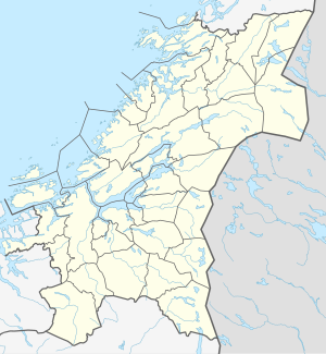
| Geographical location | Melhus ( Trøndelag ) | |
| Tributaries | Grøtvatnet and several small mountain lakes | |
| Drain | Loa → Gaula | |
| Places on the shore | Branem | |
| Location close to the shore | Hermanstad , Flå | |
| Data | ||
| Coordinates | 63 ° 10 '33 " N , 10 ° 13' 30" E | |
|
|
||
| Altitude above sea level | 184 moh. | |
| surface | 5.73 km² | |
| scope | 22.61 km | |
| Maximum depth | 92 m | |
|
particularities |
Use as a source of drinking water |
|
Benna is a lake in the Norwegian municipality of Melhus in the Trøndelag province . The lake has an area of 5.73 km² and is located at 184 moh. It serves as a drinking water supply for the community and to secure Trondheim's water supply . To protect the lake, the practice of water sports is prohibited, but it is a popular fishing area for sport fishermen due to its rich fish population.
geography
Inlet and outlet
The Benna is fed by an inlet from Grøtvatnet and by streams from the small mountain lakes Litl-Sågåsvatnet , Sågåsvatna , Svartvatnet , Storøveråvatnet and Litløveråvatnet , all of which are located east of the Bennas on a ridge. The Bennas takes place in the north over the Loa , which in turn flows into the Gaula at Flå .
Islands
There are a total of eight bars in the Benna : Brandholmen , Gaddholmen , Litlholmen , Skiholmen , Storholmen and three nameless ones . In addition , four named peninsulas protrude into the lake with the Agnesodden , the Brandodden , the Sveodden , and the Tyvodden . In addition to these there are several nameless headlands and peninsulas.
ecology
fauna
Several species of fish live in the Benna, including trout , char and three species of stickleback . The char are the dominant fish species in the lake, the individuals of which can weigh up to 3–5 kg. The trout population is also very large. The adult animals of this species in the lake usually have a mass between 1–2 kg.
It is also likely that the benna historically served as a habitat for the European eel . Whether this is still the case is unclear and, due to the lack of sighting, also unlikely. The eel has been listed on the Norwegian Red List of Threatened Species since 2006 as a species at high risk of extinction.
flora
The flora of the lake is shaped by the nutrient-poor and clear water, both in the underwater and in the bank area. In the shores of the lake there is partly specular pondweed , which is threatened with extinction in Norway and is included in the Norwegian Red List of Endangered Species with the status Vulnerable , i.e. endangered, with a high risk of extinction in nature in the immediate future. In addition to this representative of the pond herbs , thread pondweed , long-leaved pondweed and dwarf pondweed also thrive in the lake . There are also rooting water buttercups (a buttercup family ) and coniferous rushes .
Water quality
The water of the Bennas has a very good water quality and a high oxygen content even in deeper water layers. The color index of water is depending on the season, only 0 to 5, most of the value is between 3 and 5 moves the cleanliness of the water is also reflected in the low bacteriological pollution. In several measurements, a value of less than 5 E. coli bacteria per 100 ml was found. At 2.5 ° dH the water is very soft. The nutrient content in the lake is very low and is similar to that of comparable mountain lakes in the region. The phosphorus content is only 2 μg / l. The nitrogen content is also at a low level of 200 μg / l. The degree of turbidity is usually between 0.2 and 0.4 FTU . The pH value is constantly between 7.7 and 7.8.
Economical meaning
fishing
There is no commercial fishing in Benna, but the water is popular as a fishing area due to its rich fish stocks . In winter, the lake is often used by anglers for ice fishing for char.
Drinking water production
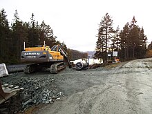
The benna is used to supply the municipality of Melhus with drinking water and is considered to be its most important source of drinking water. The idea for this use was born around 1965 by Kvåler Gustav Berg. Construction began in 1968 to develop the lake for drinking water use, when a tunnel was blown through the Loåsen mountain ridge, which was up to 310 moh high, from the north. A 1350 m long pipeline with a diameter of 5–6 m runs through this from the Råvika Bay in the north of the Bennas to a water treatment plant in which it is located. a. is weakly chlorinated . The construction work was completed with the connection to the Melhus municipality's drinking water system in 1972. The water from the Bennas currently feeds around 3,200 households, around 230 businesses and companies as well as several public institutions such as schools, old people's homes, etc.
Under the project name "MeTroVann" ( Me lhus Tro ndheim Vann , mutatis mutandis German: Melhus-Trondheim-water supply) are from Benna from pipelines to Jonsvatnet installed and associated infrastructure such as pumping stations built to the drinking water supply from Trondheim to improve and Melhus and secure in an emergency to be able to. Currently, the water is pumped out of the benna from a depth of around 17 m below the water surface. The water is to be pumped through the new pipelines from a depth of up to 45 m.
Leisure and Tourism
In order to maintain the quality of drinking water, the Benna is not only prohibited from building new buildings, but is also prohibited from swimming and boating. Apart from sport fishing, the benna itself is hardly used for recreational purposes. However, a farm not far from Grøtvannet rents out horses with which the surrounding area of the lake can be explored, sometimes on landscaped paths. There are no public sanitary facilities on the lake, but there are several huts, some of which can also be rented.
statistics
| Statistical data on the Bennas catchment area | |
| Total catchment area | 25.7 km² |
| Lake area of the Benna | 5.73 km² |
| Lake area of Grøtvannet | 2.6 km² |
| Lake area of the Benna (in% of the total catchment area) | 22.2% |
| Lake area of the Benna and Grøtvannet (in% of the total catchment area) | 32.4% |
| Mean specific annual course | 18.7 l / s per km² |
| Middle sequence at the benna in the loa | 500 l / s |
| Theoretical residence time of the water in Benna | about 10 years |
| Highest point in the catchment area | 512 moh. |
| Lowest point in the catchment area | 184 moh. |
Hydrological data
The catchment area of the Bennas is 25.7 km². In contrast to the usual practice, the water system is not related to the associated (out) flow, the loa, but to the benna. It consists of the lake Grøtvannet , the outflow that flows into the Benna, the Grøtbekken , the Benna itself and the outflows of some small mountain lakes and the 3.2 km long Loa. The Loa flows into the Gaula at Flå , so that the Benna water system is a tributary of the Gaula. In the upper section of the Loas there are several hydropower plants for generating electricity . The table opposite contains further data on the Benna water system.
See also
Web links
- Info page about the MeTroVann project on trondheim.kommune.no (Norwegian)
Individual evidence
- ↑ a b c d e Innsjødatabase Norges vassdrags- og energidirektorat, accessed on April 13, 2020 (English)
- ↑ a b c d e f g h i j k l m n o p OMDISPONERING AV VANNRESSURSENE I BENNAVASSDRAGET, MELHUS KOMMUNE (October 7, 2010) , trondheim.kommune.no, accessed on February 16, 2015 (Norwegian; PDF, 2 , 1 MB)
- ↑ Store norske leksikon : Benna , accessed on February 16, 2015 (Norwegian)
- ↑ Ål, Anguilla anguilla , artsportalen.artsdatabanken.no, accessed on June 3, 2020 (Norwegian)
- ↑ Potamogeton lucens ( Memento of the original from September 14, 2013 in the Internet Archive ) Info: The archive link was inserted automatically and has not yet been checked. Please check the original and archive link according to the instructions and then remove this notice. , artsportalen.artsdatabanken.no, accessed on February 16, 2015 (Norwegian)
- ↑ a b c d Roger Folstad: Historisk om Benna ( Memento of the original from February 17, 2015 in the Internet Archive ) Info: The archive link was inserted automatically and has not yet been checked. Please check the original and archive link according to the instructions and then remove this notice. , melhus.kommune.no, accessed on February 16, 2015 (Word doc file, 21KB)
- ↑ a b MeTroVann , trondheim.kommune.no, accessed on February 16, 2015 (Norwegian)
- ^ Topographic map of Norway (section with loa) , ut.no, accessed on February 17, 2015

