Jonsvatnet
| Jonsvatnet | ||
|---|---|---|

|
||
| The Jonsvatnet in January 2013 | ||
| Geographical location | Trondheim , ( Trøndelag ) | |
| Drain | Vikelva → Strindfjord | |
| Location close to the shore | Trondheim | |
| Data | ||
| Coordinates | 63 ° 22 ′ N , 10 ° 35 ′ E | |
|
|
||
| Altitude above sea level | 148 moh. | |
| surface | 14.26 km² | |
| scope | 43.46 km | |
| Maximum depth | 94.4 m | |
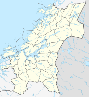
The Jonsvatnet is a reservoir in the province of Trøndelag in Norway . It is located southeast of the city of Trondheim almost entirely on the territory of the Trondheim municipality ; only a few very short stretches of shore belong to the district of Malvik . The lake is the main source of drinking water for the city of Trondheim.
The sea
The only about 15 m long dam ( 63 ° 23 '57.5 " N , 10 ° 31' 27.5" O ) at the provincial road Fv861 ( "Jonsvannsveien") in the narrow valley of the Vikelva (also called Lutelva) was originally built to meet the enormous water requirements of the large pulp and paper mill founded in Ranheim in 1884 . The factory, now part of the Peterson AS group, is now a facility for the production of recycled paper .
The lake consists of three main parts: the Storvatnet, by far the largest, in the East, the long and narrow Litlvatnet ( 63 ° 22 '30 " N , 10 ° 32' 42" O ) in the northwest and the Kilvatnet ( 63 ° 20 ' 42 ″ N , 10 ° 33 ′ 36 ″ E ) in the extreme southwest. It lies at a height of 148 m, is about 8 km long and 4.5 km wide and has a total area of 14.26 km² and a maximum depth of 94.4 m. Its coastline is very long with a total of 43.64 km because of the many bulges and side arms. There are at least 15 islands in the lake.
The lake is fed by a large number of small rivers and streams that arise in the mountains southeast of Trondheim. If its water is not fed to Trondheim by pipelines, it is drained by the Vikelva, which flows into the Strindfjord , a section of the Trondheimfjord , after about 3.5 km in Ranheim .
Since the lake is the most important drinking water reservoir for the city of Trondheim, it is subject to significant usage restrictions. This also includes the prohibition of tents and camping closer than 100 m from the lake shore. Fishing from land and from boats is permitted; The important fish species in the lake include brown trout , pike , char and burbot .
Jonsvatnet Seaplane Base
From 1936 to 1939, Det Norske Luftfartselskap (DNL) used the lake in the summer months as a seaplane base for their summer route between Bergen and Tromsø , which is operated three times a week by seaplanes , with stops in Ålesund , Molde , Kristiansund , Trondheim, Brønnøysund , Sandnessjøen , Bodø , Narvik and Harstad .
During and after the German invasion of Norway in April 1940, the frozen lake was used as an important makeshift airfield, and up to 60 Air Force aircraft were temporarily stationed there. When the ice melted, at least three aircraft were lost in the lake: a Heinkel He 111 , a Junkers Ju 88 and a Junkers Ju 52 . The wreck of the Ju 52 was destroyed during the construction of one of the water pipes in the 1980s. The wrecks of the two bombers were lifted in 2005 after several years of careful preparation. During the search for the wrecked planes, an Arado Ar 196 was found, which later crashed into the lake during the war; however, this wreck remained undisturbed as a war cemetery .
Footnotes
- ↑ Ranheim, an eastern part of Trondheim, belonged to Strinda until the municipality of Strinda was incorporated into Trondheim in 1964.
