
Bento Gonçalves
| Bento Gonçalves | ||
|---|---|---|
|
Coordinates: 29 ° 10 ′ S , 51 ° 31 ′ W Bento Gonçalves on the map of Rio Grande do Sul
|
||
| Basic data | ||
| Country | Brazil | |
| State | Rio Grande do Sul | |
| City foundation | October 11, 1890 | |
| Residents | 119,049 (2018 estimate) | |
| City insignia | ||
 |
 |
|
| Detailed data | ||
| surface | 382.513 km 2 | |
| Population density | 276.2 inhabitants / km 2 | |
| height | 691 m | |
| Time zone | UTC −3 | |
| City Presidency | Guilherme Pasin ( PP ) | |
| Website | ||
 |
||

Bento Gonçalves is a city in the state of Rio Grande do Sul in southern Brazil . It is located about 110 km north of Porto Alegre . Neighboring are the places Farroupilha , Garibaldi , Monte Belo do Sul , Veranópolis , Cotiporã , Santa Tereza and Nova Roma do Sul . Originally, Bento Gonçalves was part of the municipality of Montenegro .
The city is named after one of the leaders of the Farrapen Revolution, Bento Gonçalves da Silva .
Culture
The city is home to the Museu Histórico Casa do Imigrante migration museum .
sons and daughters of the town
- Orlando Geisel (1905–1979), General, Army Minister and Commander-in-Chief of the Army, Brother Ernesto Geisels
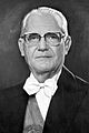
- Ernesto Geisel (1908–1996), military and politician, President of Brazil from 1974 to 1979
- Luiz Colussi (1931–1996), Catholic bishop
- Nelson Piletti (* 1944), university professor and author
- Marcus Vinícius Freire (* 1962), volleyball player, official of the Brazilian Olympic Committee
- Carlos Miguel (* 1972), football player
- Gilberto da Costa Arilson (* 1973), football player
- Rafael Luiz Fantin (* 1978), volleyball player
- Renato Benatti (* 1981), football player
- Franco Paese (* 1990), volleyball player
- Jéssica Pauletto (* 1990), model
- Andrei Girotto (* 1992), football player

Army Secretary Orlando Geisel
President Ernesto Geisel (1974)


Individual evidence
- ^ Brazilian Institute of Geography and Statistics . 2018 .: "2018 Estimates of Population"