Beuster (innermost)
| Beuster | ||
|
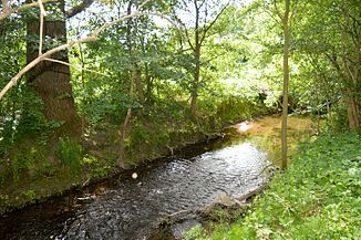
The Beuster near Marienburg (2016) |
||
| Data | ||
| Water code | DE : 488672 | |
| location | District of Hildesheim , Lower Saxony ( Germany ) | |
| River system | Weser | |
| Drain over | Innerste → Leine → Aller → Weser → North Sea | |
| origin | The confluence of the Kalter Beuster and the Warmer Beuster in Diekholzen 52 ° 5 ′ 35 ″ N , 9 ° 54 ′ 51 ″ E |
|
| Source height | approx. 125 m above sea level NHN - Cold Beuster: 220 m - Warm Beuster: 238 m |
|
| muzzle | to Marienburg in the innermost coordinates: 52 ° 7 ′ 9 ″ N , 9 ° 58 ′ 47 ″ E 52 ° 7 ′ 9 ″ N , 9 ° 58 ′ 47 ″ E |
|
| Mouth height | approx. 79 m above sea level NHN | |
| Height difference | approx. 46 m | |
| Bottom slope | approx. 7.1 ‰ | |
| length | 6.5 km | |
| Catchment area | approx. 100 km² | |
| Communities | Diekholzen | |
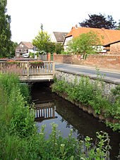
The Beuster is a 6.5 km long, left or southern tributary of the Innerste in the district of Hildesheim in southern Lower Saxony .
The Beuster rises in the Hildesheim forest . In the area of the village of Diekholzen , the Kalte Beuster (right or southeastern source stream of the Beuster) and the Warme Beuster (left or northwestern source stream of the Beuster) unite. The Beuster then flows in an easterly direction through the Söhre district of Diekholzen , and then flows into the Innerste at Hildesheim-Marienburg.
See also
Individual evidence
- ↑ a b Die Beuster ( memento of March 29, 2017 in the Internet Archive ) on a topographic map (TK 100), height information according to contour lines . Experience nature portal on Niedersachsen.de.
Web links
Commons : Beuster - collection of images, videos and audio files

