Bleichbach (Kaltenbach)
| Bleichbach | ||
|
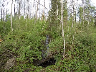
Bleichbach near Au Eulenau |
||
| Data | ||
| Water code | DE : 182834 | |
| location | Raubling municipality , Rosenheim district , Upper Bavaria , Germany | |
| River system | Danube | |
| Drain over | Kaltenbach → Mangfall → Inn → Danube → Black Sea | |
| source | at Kematen 47 ° 48 ′ 31 ″ N , 11 ° 56 ′ 44 ″ E |
|
| Source height | approx. 584 m | |
| muzzle | at the Feilnbach peat plant Coordinates: 47 ° 48 '32 " N , 12 ° 1' 9" E 47 ° 48 '32 " N , 12 ° 1' 9" E |
|
| Mouth height | 470 m | |
| Height difference | approx. 114 m | |
| Bottom slope | approx. 26 ‰ | |
| length | 4.3 km | |
| Catchment area | 9.08 km² | |
The Bleichbach is a year-round flowing water in the Alpine foothills west of Raubling in the Upper Bavarian district of Rosenheim .
It rises near Kematen and runs largely eastwards to its confluence with the Kaltenbach .
Individual evidence
- ↑ a b List of brook and river areas in Bavaria - Inn river area, page 13 of the Bavarian State Office for the Environment, as of 2016 (PDF; 2.8 MB)
