
Bode (rocker)
| Bode | ||
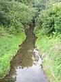
.svg) The Bode and the upper reaches of the Wipper |
||
| Data | ||
| Water code | DE : 56464 | |
| location | Districts of Eichsfeld and Nordhausen , Thuringia , Germany | |
| River system | Elbe | |
| Drain over | Wipper → Unstrut → Saale → Elbe → North Sea | |
| source | In the Ohm Mountains south of Holungen 51 ° 28 ′ 7 ″ N , 10 ° 22 ′ 21 ″ E |
|
| Source height | approx. 467 m above sea level NHN | |
| muzzle | East of Bleicherode in the Wipper coordinates: 51 ° 27 ′ 7 ″ N , 10 ° 36 ′ 42 ″ E 51 ° 27 ′ 7 ″ N , 10 ° 36 ′ 42 ″ E |
|
| Mouth height | 221 m above sea level NHN | |
| Height difference | approx. 246 m | |
| Bottom slope | approx. 12 ‰ | |
| length | 20 km | |
| Catchment area | 105 km² | |
| Discharge at the Bleicherode A Eo gauge : 104 km² Location: 1.5 km above the mouth |
NNQ (September 17, 1997) MNQ 1952–2014 MQ 1952–2014 Mq 1952–2014 MHQ 1952–2014 HHQ (April 20, 1983) |
50 l / s 150 l / s 820 l / s 7.9 l / (s km²) 13.4 m³ / s 52.6 m³ / s |
The Bode is an approximately 20 km long, west-northwest and left tributary of the Wipper in the districts of Eichsfeld and Nordhausen in Thuringia .
geography
course
The headwaters of the Bode is located in Ohmgebirge south of Holungen between the Black Mountain ( 491.4 m above sea level. NHN ) in the north, the Ochsenberg ( 514.6 m ) to the southeast and the Bornberg ( 529.7 m ) to the southwest. The main source is located at the former Seegel forester's house .
The Bode first flows through Holungen in a northerly direction and further south-eastwards to Bischofferode , Großbodungen , Kleinbodungen and Lipprechteode , before finally flowing into the Wipper at Bleicherode .
Catchment area and tributaries
The catchment area of the Bode is 105 km². Its tributaries include:
- Fischbach (right) near Holungen
- Pfaffengrund (left) between Holungen and Bischofferode
- Bopperöder Bode or Bach (left) near Bischofferode
- Hauröder Bach (right) between Bischofferode and Großbodungen
- nameless brook (left) near Großbodungen
- Hagebach (right) at Großbodungen
- Herche (right) at small floors
- Krajaer Bach (right) between Kleinbodungen and Lipprechteode
- Bauerngrund (brook from Helenenhof) (left) between Kleinbodungen and Lipprechterode
- Bleiche (right) northeast of Bleicherode
Runoff, salinization and water quality
The long-term mean discharge of the Bode is above 0.8 m³ / s. In the upper reaches, the river is rated as “slightly polluted” ( water quality class 2). Its lower course is polluted by production wastewater from the potash industry. This wastewater is discharged into Bleicherode-Ost. The Thuringian State Institute for Environment and Geology has already identified a "critical pollution" (water quality class 2–3).
Picture gallery

The Bode in Bischofferode, seen towards Holungen

The Bode in Bischofferode
The river in Kleinbodungen

The Bode in Kleinbodungen


Individual evidence
- ^ According to BfN map 1: 10000 geodienste.bfn.de and TK 50 Nördliches Eichsfeld
- ↑ a b Topographic map 1: 25,000
- ↑ a b c d Michael Bergemann: Complete list of flowing waters in the Elbe catchment area . Authority for Environment and Energy, Hamburg July 1, 2015 ( fgg-elbe.de (PDF; 802 kB) [accessed on November 29, 2015]).
- ^ A b Thuringian State Institute for the Environment (ed.): Area and waterway key figures (directory and map). Jena 1998. 26 pp.
- ^ German Hydrological Yearbook Elbe Region, Part I 2014. (PDF) State Office for Flood Protection and Water Management Saxony-Anhalt, p. 180 , accessed on November 3, 2018 (from: lhw.sachsen-anhalt.de).
- ↑ angelverein-nordhausen.de
- ↑ Water quality, flowing water 2006 (PDF; 413 kB) tlug-jena.de
Web links
- The Bode at OpenStreetMap