Bolshaya (Kamchatka)
|
Bolshaya Больша́я, Bystraja (Быстрая) |
||
|
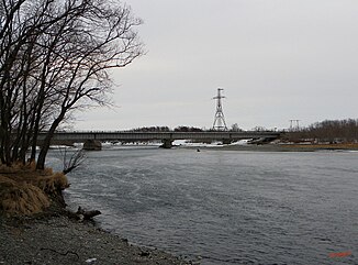
The bridge over the Bystraja, built in 1975. |
||
| Data | ||
| Water code | RU : 19080000212120000025788 | |
| location | Kamchatka Region ( Russia ) | |
| River system | Bolshaya | |
| Headwaters |
Ganalski Mountains (part of the Vostochny ridge ) 53 ° 55 ′ 4 ″ N , 157 ° 54 ′ 56 ″ E |
|
| Source height | approx. 1000 m | |
| muzzle |
Sea of Okhotsk coordinates: 52 ° 43 ′ 40 " N , 156 ° 13 ′ 8" E 52 ° 43 ′ 40 " N , 156 ° 13 ′ 8" E |
|
| Mouth height | 0 m | |
| Height difference | approx. 1000 m | |
| Bottom slope | approx. 3.6 ‰ | |
| length | 275 km | |
| Catchment area | 10,800 km² | |
| Outflow location: 96 km above the mouth |
MQ |
123 m³ / s |
| Discharge at the gauge near the mouth of the A Eo : 10,800 km²
|
MQ Mq |
317 m³ / s 29.4 l / (s km²) |
| Left tributaries | Plotnikowa , Golzowka | |
| Right tributaries | Natschilowa | |
The Bolshaya ( Russian Больша́я , in the upper reaches of Bystraja (Быстрая)) is a river in the extreme southwest of the Kamchatka Peninsula in the Far East of Russia .
River course
The Bolshaya rises as Bystraja in the Ganalski Mountains , which is part of the Vostochny ridge . In the upper reaches it flows mainly in a southerly direction through the mountains. It later turns to the west and finally flows into an elongated lagoon of the Sea of Okhotsk , which opens only 35 km further south to the sea. The Ust-Bolsheetsk and Oktyabrsky settlements are located near the mouth of the river. Above the mouth of the Plotnikowa at river kilometer 58 the river is called "Bystraja". The river has a length of 275 km.
Hydrology
The Bolshaya drains an area of 10,800 km². The mean discharge (MQ) is 317 m³ / s. The river is navigable in the lower reaches.
Fish fauna
Several salmon fish use the river system Bolshaya for spawning , including pink salmon , chum salmon , coho salmon , sockeye and king salmon .
Web links
- Большая bei water-rf.ru (НАУЧНО-ПОПУЛЯРНАЯ ЭНЦИКЛОПЕДИЯ; Вода России) (Russian)
