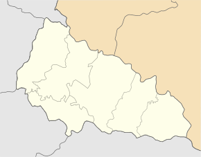
Botfalwa
| Botfalva | ||
| Ботфалва | ||

|
|
|
| Basic data | ||
|---|---|---|
| Oblast : | Zakarpattia Oblast | |
| Rajon : | Uzhhorod Raion | |
| Height : | 106 m | |
| Area : | 1.318 km² | |
| Residents : | 625 (2016) | |
| Population density : | 474 inhabitants per km² | |
| Postcodes : | 89420 | |
| Area code : | +380 3137 | |
| Geographic location : | 48 ° 35 ' N , 22 ° 12' E | |
| KOATUU : | 2124886802 | |
| Administrative structure : | 1 village (Selo) | |
| Address: | вул. Горького буд. 107а 89420 с. Тарнівці |
|
| Website : | City council website | |
| Statistical information | ||
|
|
||
Botfalwa ( Ukrainian Ботфалва ; Russian Ботфалва , Slovak Botfalva, Botfala , Hungarian Botfalva ) is a village in the west of the Ukrainian Zakarpattia Oblast with about 620 inhabitants (2016) and an area of 1.318 km².
Botfalwa belongs administratively to the district council of the village of Tarnivtsi in the west of Uzhhorod district .
geography
The village lies on the banks of the Usch , a 133 km long tributary of Laborec , 1 km west of the community center and 9 km southwest of the Rajon- and Oblastzentrum Uzhhorod .
history
The village, first mentioned in writing in 1427, had in the past the names of Prykordonne ( Прикордонне ) and Batfalwa ( Батфалва ). In the 16th century there were 9 households and 35 serf families in the village. In connection with an epidemic, the population dropped to only 6 families in 1567. At the 2001 census, the village had 579 inhabitants. The population consists of Ukrainians, Hungarians, Russians and Roma .
ethnicities
In 2001, 65% of the inhabitants of Botfalwa were Magyars , 23% Ukrainians , 10% Russians and 2% Slovaks .
Web links
- Tarnivtsi District Council website (Ukrainian)
Individual evidence
- ↑ a b c d Local history of Botfalwa on the Tarnivzi District Council website (Ukrainian); accessed on July 20, 2019.
- ↑ a b local website on the official website of the Verkhovna Rada (Ukrainian); accessed on April 5, 2018.

