Bouès
| Bouès | ||
|
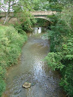
The river at Marciac |
||
| Data | ||
| Water code | FR : Q06-0400 | |
| location | France , Occitania region | |
| River system | Adour | |
| Drain over | Arros → Adour → Atlantic Ocean | |
| origin | at the municipal boundary of Ozon and Burg 43 ° 10 ′ 45 ″ N , 0 ° 17 ′ 53 ″ E |
|
| Source height | approx. 503 m | |
| muzzle | in the municipality of Beaumarchés in the Arros Coordinates: 43 ° 33 ′ 56 " N , 0 ° 5 ′ 48" E 43 ° 33 ′ 56 " N , 0 ° 5 ′ 48" E |
|
| Mouth height | approx. 135 m | |
| Height difference | approx. 368 m | |
| Bottom slope | approx. 5.8 ‰ | |
| length | 63 km | |
| Left tributaries | Laüs | |
| Reservoirs flowed through | Lac de Sère-Rustaing, Lac de Marciac | |
The Bouès is a river in France that runs in the Occitania region . Its origin is on the municipal boundary of Ozon and Burg near the hamlet of Castéra-Ozon . This is where the 14-kilometer Canal de Bouès flows , which is supplied with water by the Canal de la Neste southwest of Lannemezan . The Bouès generally drains in a northerly direction, swings in the last third of its course to the northwest and flows into the Arros as a right tributary after a total of 63 kilometers in the municipality of Beaumarchés , near the former mill of Espalanque . On its way, the Bouès crosses the Hautes-Pyrénées and Gers departments .
Places on the river
Web links
Commons : Bouès - collection of images, videos and audio files
Individual evidence
- ↑ Source geoportail.fr (1: 32,000)
- ↑ estuary geoportail.fr (1: 16,000)
- ↑ a b The information on the length of the river is based on the information on the Bouès from SANDRE (French), accessed on June 26, 2012, rounded to full kilometers.
