Bramont
| Bramont | ||
|
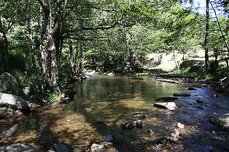
The river at Saint-Étienne-du-Valdonnez |
||
| Data | ||
| Water code | FR : O7030500 | |
| location | France , Occitania region | |
| River system | Garonne | |
| Drain over | Lot → Garonne → Atlantic Ocean | |
| source | in the municipality of Saint-Étienne-du-Valdonnez 44 ° 26 ′ 34 ″ N , 3 ° 39 ′ 42 ″ E |
|
| Source height | approx. 1530 m | |
| muzzle | just south of Balsièges in the Lot Coordinates: 44 ° 28 ′ 45 " N , 3 ° 27 ′ 11" E 44 ° 28 ′ 45 " N , 3 ° 27 ′ 11" E |
|
| Mouth height | approx. 680 m | |
| Height difference | approx. 850 m | |
| Bottom slope | approx. 34 ‰ | |
| length | 25 km | |
The Bramont is a river in France that runs in the Lozère department in the Occitanie region . It rises in the Cevennes National Park , in the municipality of Saint-Étienne-du-Valdonnez , initially drains in a south-westerly direction, then swings to the north-west and after 25 kilometers flows into the Lot as a left tributary just south of Balsièges .
Places on the river
Web links
Commons : Bramont - collection of images, videos and audio files
