Bridgeport, Alabama
| Bridgeport | |
|---|---|
|
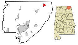
Location in County and Alabama
|
|
| Basic data | |
| Foundation : | 1852 |
| State : | United States |
| State : | Alabama |
| County : | Jackson County |
| Coordinates : | 34 ° 57 ′ N , 85 ° 43 ′ W |
| Time zone : | Central ( UTC − 6 / −5 ) |
| Residents : | 2,418 (as of 2010) |
| Population density : | 298.5 inhabitants per km 2 |
| Area : | 8.4 km 2 (approx. 3 mi 2 ) of which 8.1 km 2 (approx. 3 mi 2 ) are land |
| Height : | 205 m |
| Postal code : | 35740 |
| Area code : | +1 256 |
| FIPS : | 01-09328 |
| GNIS ID : | 0114905 |
Bridgeport is a city in Jackson County in the state of Alabama in the United States .
geography
Bridgeport is located in northeast Alabama in the southern United States. Part of the northern city limits also forms part of the northern Alabama- Tennessee border .
Nearby places include South Pittsburg (immediately to the north), New Hope (1 km northeast), Stevenson (4 km southwest), Bryant (5 km east) and Orme (6 km northwest). The next larger city is Chattanooga, about 25 kilometers to the east with 171,000 inhabitants .
history
The city originated as Jonesville in the early 19th century. In 1852 a post office and the Nashville, Chattanooga and St. Louis Railway were opened. After a new railroad bridge was built over the Tennessee River in 1854 and a port shortly before that, the name was changed to Bridgeport .
Due to its location on the railroad and the Tennessee River, Bridgeport was an important location during the Civil War , and the bridge in particular was often the target of military attacks. The warship USS Chattanooga was built in the local port .
In 2011 a severe storm in the southern United States left Bridgeport dead.
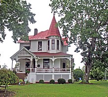
Two structures and sites in Bridgeport and the surrounding area are listed on the National Register of Historic Places (NRHP) as of March 20, 2020, the Bridgeport Historic District and the Russell Cave National Monument .
traffic
Part of the western metropolitan area includes a route on which US Highway 72 and Alabama State Route 2 run together. There is a connection to Interstate 24 about 6 kilometers north, and Interstate 59 and US Highway 11 run 20 kilometers east .
The city-owned Bridgeport Municipal Airport is about 7 kilometers southwest and Marion County Airport is 14 kilometers northeast .
Demographics
The 2000 census showed a population of 2728, divided between 1159 households and 793 families. The population density was 338 people per square kilometer. 87.8% of the population were white, 8% black, 1.4% Native American and 0.1% Asian. 0.4% were of a different ethnicity , 2.3% had two or more ethnicities, and 1.3% were Hispanics or Latin Americans of any ethnicity. For every 100 women there were about 90 men. The median age was 38 years and the per capita income was 15,779 US dollars, which put about 13.4% of the population below the poverty line.
By the 2010 census , the population had dropped to 2,418.
Web links
- Statistical data Bridgeport (Engl.)
- Bridgeport in the Encyclopedia of Alabama (Engl.)
Individual evidence
-
↑ Search mask database in the National Register Information System. National Park Service , accessed March 20, 2020.
Weekly List on the National Register Information System. National Park Service , accessed March 20, 2020.

