Brodten
|
Brodten
City of Lübeck
Coordinates: 53 ° 59 ′ 15 ″ N , 10 ° 51 ′ 40 ″ E
|
||
|---|---|---|
| Height : | 13 m | |
| Residents : | 118 (Dec. 31, 2003) | |
| Area code : | 04502 | |
|
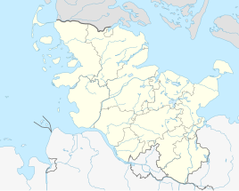
Location of Brodten in Schleswig-Holstein |
||
The Schleswig-Holstein village of Brodten is the northernmost and with only 118 inhabitants (as of 2003) one of the smallest districts of the Hanseatic City of Lübeck and belongs to the Lübeck-Travemünde district .
Brodten is located in the Travemünder Winkel , about three kilometers north of the center of Travemünde near the Brodtener Ufer , a cliff on the Baltic Sea that extends between Travemünde and the Ostseebad Niendorf , which belongs to the municipality of Timmendorfer Strand and is located about two kilometers west of Brodten .
history
The village that was created in the formerly dense forest of the Travemünder Winkel has belonged to the cathedral chapter since 1446. In 1759/60 it comprised 8 full hooves, 1 half hoof and several farmers subject to tax. The number of full hooves had already been reduced to 7 in 1890 and today (1993) there are only four farms left.
The former village of the Lübeck cathedral chapter has belonged to the Lübeck sovereign territory since the Reichsdeputationshauptschluss 1803 and was incorporated into the city of Lübeck on March 1, 1935.
Old farming families and farms in the Travemünder Winkel
The long-established farming families in Brodten include:
- Brinckmann Farm; Hans Hinrich Brinckmann is a full-time man and member of the board of St Jürgen Siechenhaus , Travemünde
- Hof Werner; Arend Hinrich Werner is a full-time farmer and farmer
- Borchert farm
- Hof Kahrstedt; the farm was owned by the Karstedt family from 1705 to 1951.
tourism
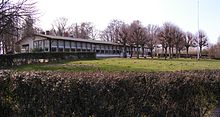
In Brodten, in addition to a leisure home for young people, there are some overnight accommodations in holiday apartments and private accommodation.
The main attraction is the Brodtener Ufer , also called the Brodtener (steep) coast , to the east and north of the village . It is a cliff about 3.5 kilometers long and up to 20 meters high , which is exposed to erosion and can therefore greatly change its appearance.
The Brodtener Ufer is a well-attended excursion destination, especially during the Travemünde Week , but also when the weather is good. On the cliff is the Hermannshöhe café-restaurant , whose name goes back to the consul Hermann Fehling , who liked to stay here. A street in Travemünde was named after him. In 2012 the previous building was replaced by a new one.
There is a golf course south of Brodten.
traffic
The next motorway exits are at Lübeck and Ratekau on the A 1 and A 226 . The federal highway 76 from Lübeck-Travemünde to Kiel runs west of the place.
Lübeck Hauptbahnhof is the nearest IC / EC train station, regional trains stop in Lübeck-Travemünde or Timmendorfer Strand.
The Travemünde – Niendorf railway line with a stop at Brodten was shut down in 1974 and then dismantled. Today a cycling and hiking trail runs over large sections of the former railway line .
There are regular bus connections to Lübeck-Travemünde and Timmendorfer Strand.
Web links
- Brodten and the Brodtener Ufer on brodten.de
- Brodten with his Brodtener Ufer on brodtener-ufer.de
Individual evidence
- ↑ City of Lübeck: ANGER VILLAGE Brodten . In: HISTORICAL CULTURAL LANDSCAPES IN LÜBECK . No. 01-003-000 . Lübeck April 19, 1993.
- ^ Lübeck State: Lübeck State Handbook of 1829 .
- ^ Lübeck State: Lübeck State Calendar 1851 .
- ↑ a b Heidrun u. Reiner Schmitz. Hamburg: Christians 1986: 200 years of Karstedtscher Hof Lübeck-Brodten 1786–1986. Ed .: ZVLGA. tape 1986 , no. 67 .


