Brough (East Riding of Yorkshire)
| Brough | ||
|---|---|---|
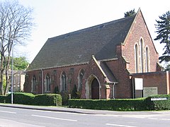
| All Saints Church | ||
| Coordinates | 53 ° 44 ′ N , 0 ° 34 ′ W | |
|
|
||
| Residents | 7000 (as of 2001) | |
| administration | ||
| Post town | BROUGH | |
| ZIP code section | HU15 | |
| prefix | 01482 | |
| Part of the country | England | |
| region | Yorkshire and the Humber | |
| Shire county | East Riding of Yorkshire | |
| District | East Riding of Yorkshire | |
| British Parliament | Haltemprice and Howden | |
Brough [ brʌf ] is a small town in the English Unitary Authority East Riding of Yorkshire . According to the 2001 census, Brough had a total of 7,000 residents.
geography
Brough is about 15 km west of Kingston upon Hull on the north bank of the Humber estuary .
Economy and Infrastructure
The most important employer in the 20th century was the aviation industry with its own works airfield, the Brough Aerodrome , today an industrial park in addition to a reduced aircraft construction site.
traffic
To the north, the A63 A-road passes the city and continues about 8 km further west than the M62 towards Manchester and Liverpool , a major east-west axis in Great Britain.
Brough is on the Hull to Selby and York or Doncaster rail line . There are direct connections to London with First Hull Trains and East Coast . First TransPennine Express offers connections to Leeds, Manchester, Manchester Airport and Liverpool , among others . Northern Rail serves the route to York, Leeds , Doncaster and Sheffield . To the east, all trains end at Hull Paragon Station , where you can connect to Scarborough via the Yorkshire Coast Line .


