Bubenik (mountain)
| Bubenik | ||
|---|---|---|
|
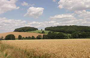
Double peaks of the Bubenik (right) and the Kleiner Landeskrone (left) |
||
| height | 375.9 m | |
| location | Free State of Saxony , Germany | |
| Mountains | Lusatian highlands | |
| Coordinates | 51 ° 5 '57 " N , 14 ° 36' 40" E | |
|
|
||
| rock | basalt | |
The Bubenik , in Upper Sorbian Bubnik , also called Großdehsaer Berg or Mittaschberg , is a 375.9 m high mountain in Upper Lusatia .
location
The basalt mountain is located 4 km west of Löbau . North are the district Löbauer Großdehsa and Lawalder district Kleindehsa . Both villages are separated by the valley of the Litte , which represents the western and southern borders of the mountain and separates it from the Kötzschauer Berg opposite, which belongs to the Czorneboh massif. The Bubenik forms a double peak with the Kleiner Landeskrone (376.9 m) located 300 m to the north. On the eastern slope of the Bubenik is the source of the Seltenrein , on which the village of Oelsa extends.
The name of the mountain comes from Sorbian , but its exact derivation is unclear. A connection with the Upper Sorbian bubno (drum) due to its shape is speculative.
The Bubenik and the small country crown form a double peak made up of two volcanic cones of about the same height, between which there is a saddle at 361 m. The name Kleine Landeskrone is explained by the similarity of the summit with the 420 m high Landeskrone near Görlitz . The Bubenik offers a wide view over the valley of the Löbauer water with the town of Löbau and the Löbauer Berg , to the northern Lausitzer Bergland , to the Rotstein , the Landeskrone and the Kottmar .
A basalt columnar formation is visible on its summit, which is known as a lion's head because of its shape . The northern summit "Kleine Landeskrone" is covered with deciduous forest, while the more rocky southern summit is covered by dry shrubbery. The former quarry began around 1850 and was used to extract gravel. It was discontinued around 1905. Because of its rare flora, which include the bird's nest root and the sanicle , the mountain was declared a natural monument in 1938 .
literature
- Between Strohmberg, Czorneboh and Kottmar (= values of our homeland . Volume 24). 1st edition. Akademie Verlag, Berlin 1974.


