Bulau (Roedermark)
|
Bulau
City of Rödermark
Coordinates: 49 ° 58 ′ 46 ″ N , 8 ° 46 ′ 45 ″ E
|
|
|---|---|
| Height : | 181 m above sea level NHN |
| Residents : | 91 (December 31, 2016) |
| Postal code : | 63322 |
| Area code : | 06074 |
|
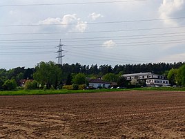
The Bulau district photographed from a bicycle path running parallel to the Dreieichbahn. The resident hotel can be seen on the right-hand side of the picture.
|
|
Bulau or Auf der Bulau is located in the Urberach district and is a district of Rödermark in the Offenbach district in Hesse .
Geographical location
The Bulau is a two-kilometer-long west-east facing and wooded ridge that lies between Urberach in the southeast, Offenthal in the west and Hexenberg (Dietzenbach) in the north; a large part of the district boundary between Dietzenbach and Urberach follows the ridge line . The ridge consists of huge piles of drifting sand from the Ice Age , which reach a height of 215.6 m in the Dietzenbach area of the Hexenberg and still 203.9 m at an underground water reservoir on the border with Urberach . This is the highest point in the urban area of Rödermark. To the south of it, 450 m from the water reservoir, on the edge of the forest lies the Bulau settlement named after the ridge, one and a half kilometers northwest of the center of Urberach.
history
The current district of Bulau used to serve as a housing estate for the workers of the Telefonbau & Normalzeit factory, who originally lived in Frankfurt am Main , in 1940 (later Telenorma , closed in 1996). During the Second World War , this housing estate was mistaken for a Wehrmacht training camp and bombed.
Economy and Transport
Bulau is a quiet residential area on the edge of the forest. It is opened up for inter-regional traffic with the 400-meter-long Bulauweg spur road , which branches off the federal highway 486 , which passes south and crosses the single-track Dreieichbahn with a level crossing 100 meters in front of the settlement .
The Odenwaldblick Hotel and the Naturfreundehaus Bulau , a restaurant with guest rooms, are located in the settlement .
Culture and sights
Every year on the forest festival area to the east of the settlement, the Bulaufreizeit for children between the ages of seven and fourteen takes place, which was initiated in 1976 by the then Catholic priest.
The cultural and historical adventure site "Auf der Bulau" was built here, and part of the ancient Roman road "Hohe Straße" to Dieburg, which ran there, was reconstructed. Likewise, Celtic barrows were heaped up to their presumed original height and a Celtic funeral procession was recreated with a group of figures designed by the artist Kai Wujanz.
At the highest point of the Bulau in the forest, which reaches around 210 meters, there is an elevated tank from the Hergershausen waterworks , which is used for sledding in winter.
Individual evidence
- ↑ Rödermark - Statistics In: roedermark.de. Accessed October 2017.
- ↑ Landscape plan UVF, as of December 2000, page 25 of the PDF file 1.55 MB
- ↑ Elevation information taken from the topographic map
- ↑ Documentation center T&N on the Internet
- ↑ "Bulau" adventure site on Celtic worlds
Web links
- Website of the city of Rödermark
- "On the Bulau, Offenbach district". Historical local dictionary for Hessen. (As of June 25, 2014). In: Landesgeschichtliches Informationssystem Hessen (LAGIS).

