
Burkes Pass
|
Burkes Pass Māori: Te Kopi Opihi |
||
| Geographical location | ||
|
||
| Coordinates | 44 ° 5 ′ S , 170 ° 39 ′ E | |
| Region ISO | NZ-CAN | |
| Country |
|
|
| region | Canterbury | |
| District | Mackenzie District | |
| Ward | Opuha Ward | |
| Residents | few | |
| height | 520 m | |
| Post Code | 7987 | |
| Telephone code | +64 (0) 3 | |
| Photography of the place | ||
 View of the tourist center of the settlement |
||

Burkes Pass is a small settlement in the Mackenzie District of Canterbury on the South Island of New Zealand .
geography
The settlement is located on New Zealand State Highway 8 , 14 km west of Fairlie and around 16 km southeast of Lake Tekapo . Embedded by the Two Thumb Range in the north, the Rollesby Range in the southwest and the Albury Range in the east, the settlement lies at an altitude of 520 m . Only to the south does the expanse of the Rollesby Valley open up, from there the Opihi River also flows north and touches the settlement on its southern to eastern side.
Mountain pass
The pass of the same name, called in the language of the Māori Te Kopi Opihi , overcomes an altitude of 670 m and is also on State Highway 8 , 4 km west of the settlement. The Burkes Memorial is also located on the pass .
history
The pass and later the settlement was named after the Irish Michael John Burke , who in 1855 was the first European to overcome the pass with a team of oxen and, with the passage, paved the way for the settlement of the country that was later called Mackenzie Country . In his honor, a memorial stone with an inscription was erected on the pass road in 1917.
The Burkes Pass settlement was the outpost of civilization in those days. The early settlers came to have their sheep shown in this area. They built a small wooden church in 1872, which is now known as St Patrick's Church and is New Zealand's oldest Union Church. Most of the buildings erected at that time can still be found in the settlement today and are a tourist attraction for travelers.
Photo gallery
- Burkes Pass impressions

Service station

Store and Merchandise

Three Creeks Trading Co

Mount Cook Road Board Office

The Musterer's hat
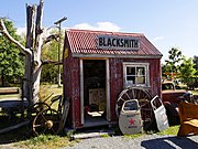
Blacksmith


Web links
Individual evidence
- ↑ a b Topo250 maps . Land Information New Zealand , accessed January 27, 2020 .
- ↑ a b Burkes Pass, Canterbury . In: NZ Topo Map . Gavin Harriss , accessed January 27, 2020 .
- ↑ Burkes Pass . In: Mackenzie Region New Zealand . ChristchurchNZ , accessed January 27, 2020 .