New Zealand State Highway 8
| State Highway SH8 in New Zealand | |

|
|
| map | |
| Basic data | |
| Operator: | New Zealand Transport Agency |
| Start of the street: |
Washdyke ( 44 ° 21 ' S , 171 ° 14' O ) |
| End of street: |
Milton ( 46 ° 8 ′ S , 169 ° 55 ′ E ) |
| Overall length: | 457 km |
|
Regions : |
|
| Deadmans Point Bridge, heading towards Cromwell | |
The New Zealand State Highway 8 ( State Highway 8 or SH 8 for short ) is a trunk road of national importance on the South Island of New Zealand .
geography
The State Highway 8 has a length of 457 km and was one of eight former national State Highways . It forms a counterclockwise semicircle and runs through the Mackenzie Basin and the Central Otago District . The beginning and end of the highway are interchanges on State Highway 1 . The kilometers run from north to south.
In both cities and rural areas, the SH 8 is for the most part a street with one lane in each direction of travel with intersections and property entrances, i.e. it corresponds roughly to a federal road / main road .
route

The SH 8 branches off in Washdyke , an industrial suburb of Timaru , and initially runs northwest to Fairlie . From here the route runs west and quickly gains altitude. It passes the southern end of the two great lakes of the Mackenzie Basin, Lake Tekapo and Lake Pukaki .
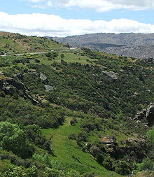
From Pukaki the road turns southwest and crosses the upper part of the valley of the Waitaki River and the towns of Twizel and Omarama . Then the road climbs again and reaches its highest point with the 971 m high Lindis Pass . The road now follows the valley of the Lindis River and reaches the upper reaches of the Clutha River near Tarras .
From here the highway runs near the east coast of Lake Dunstan and reaches the town of Cromwell at its southern end . From here the SH 8 follows the Clutha through the Cromwell Gorge and in Clyde passes the Clyde Dam , New Zealand's largest hydroelectric dam. The road follows the Clutha through Alexandra and meets the SH 85 here. It now runs south on the west bank of the Clutha and Lake Roxburgh to Roxburgh . A large part of this section leads through orchards and along the mining areas of the gold rush in Otago .
From Roxburgh the SH 8 follows a south-easterly direction. It crosses Ettrick , Raes Junction and Beaumont . There the SH8 leaves the Clutha valley in the direction of Lawrence . From there, the road runs over Waitahuna and the winding Manuka Gorge to then reach the plain of the Tokomairiro River at Clarksville , three kilometers south of Milton . The second connection of the SH 8 to the SH 1 is located here.
The SH 8 has two branches, the SH 8A and the SH 8B. These connect it to State Highway 6 on the west bank of Lake Dunstan. State Highway 8A runs over 23 km from SH 6 at Luggate to the connection to SH 8 near Tarras. State Highway 8B is only 1.6 miles long and runs from SH 8 at Deadmans Point across the lake to Cromwell.
Route changes:
The course of the SH 8 between Clyde and Tarras was changed in the 1980s because of the construction of the Clyde dam. This flooded a large part of Cromwell Gorge , including the previous route. Therefore a completely new section was built between Clyde and Cromwell. The previous bridge with only one common lane for both directions was replaced by a two-lane bridge 1.5 km north of the old location.
statistics
In 2011 the SH 8 had an annual average traffic volume between 1219 vehicles in Bendigo and 8253 vehicles in the through-hole of Alexandra. At the eleven measuring points between nine and 18% of the vehicles had a mass of 3.5 t or more. The SH 8A had an average traffic volume of 646 to 858 vehicles, the SH 8B between 3930 at the Deadmans Point Bridge and 4500 near the connection with the SH 6.
Important junctions
| District | place | km | Connection after | Remarks |
|---|---|---|---|---|
| Timaru District | Washdyke | 0 |
Temuka , Christchurch |
SH 8 begins |
|
Timaru, Dunedin |
||||
| Mackenzie District | Fairlie | 57 |
Geraldine , Christchurch |
alternative route to Christchurch, bypassing Timaru |
| Lake Pukaki | 146 |
Glentanner , Aoraki / Mount Cook |
||
| Waitaki District | Omarama | 185 |
Kurow , Oamaru |
|
|
Lindis Pass 971 m |
||||
| Central Otago District | ||||
| Tarras |
Wanaka , West Coast |
|||
| Cromwell |
Cromwell, Queenstown |
|||
| Alexandra |
Ranfurly , Dunedin |
|||
| Raes Junction |
Tapanui , Gore |
The branch is on the district boundary | ||
| Clutha District | ||||
| Clarksville | 460 |
Milton , Dunedin |
SH 8 ends | |
|
Balclutha , Invercargill |
literature
- New Zealand Travel Atlas , Wise Maps Auckland. ISBN 0-908794-47-9 .
Web links
Individual evidence
- ↑ State Highway traffic data booklet: 2007-2011. (PDF; 7.4 MB) NZ Transport Agency , accessed on October 7, 2012 (English).


