New Zealand State Highway 87
| State Highway SH87 in New Zealand | |

|
|
| Basic data | |
| Operator: | New Zealand Transport Agency |
| Start of the street: |
Mosgiel ( 45 ° 53 ′ S , 170 ° 21 ′ E ) |
| End of street: |
Kyeburn ( 45 ° 9 ′ S , 170 ° 16 ′ E ) |
| Overall length: | 113 km |
|
Regions : |
|
| Development condition: | 2 × 1 lane |
|
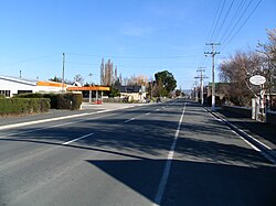
New Zealand State Highway 87 , Swansea Street in Middlemarch |
|
The New Zealand State Highway 87 ( State Highway 87 or SH 87 for short ) is a national highway on the South Island of New Zealand .
geography
The trunk road has a length of 113 km and is located in the southeastern part of the South Island. The two-lane road over its entire length (one in each direction of travel) connects State Highway 1 west of Dunedin and State Highway 85 near the small settlement of Kyeburn , next to the Kye Burn River , in northern Otago . The road leads through the dry and warm highlands of Otago in summer and snowy and cold in winter .
Routing
The State Highway 87 begins approximately 11.5 km west of the center of Dunedin and 1.5 km south of the center of Mosgiel at the exit from State Highway 1 to Mosgiel . After approx. 500 m the road crosses the railway line of the Taieri Gorge Railway , which offers a train connection for tourists to the highlands from Otago to Middlemarch . Then following the main road from Mosgiel , the SH 87 bends a few hundred meters after leaving the town to the northwest and west and crosses the communities of Riverside and Outram and crosses the Taieri River for the first time . About 2 km after leaving Outram, the road makes a small swivel to the north-west and then plunges into the highlands of Otago . After about 21 km and a turn to the north, the road passes Clarks Junction , from where the Old Dunstan Road branches off to the west. After around 23 km through dry highlands, the SH 87 passes the small settlement of Sutton . From there, the Sutton Salt Lake , located around 3 km to the southwest, can be visited. Shortly before Sutton, the SH 87 crosses the railway line of the Taieri Gorge Railway and after leaving town follows the line with another junction to the north until the road reaches Middlemarch after 6.3 km . This is where the railway line ends in the eastern part of the village, whereas the SH 87 strives further north and then swings to the northeast after about 8.5 km after leaving Middlemarch . 20 km before reaching the State Highway 85 crosses the 87 SH nor the small settlement Hyde crosses 5.8 kilometers before reaching its end points the Taieri River a second time and then comes to a total of 113 kilometers of road just east adjacent to the river Kye Burn on State Highway 85 .
On its way from south to north, the SH 87 passes the town of Mosgiel , followed by Outram and the small settlements of Harveys Flat , Lee Stream , Clarks Junction , Shannon , Sutton , the village of Middlemarch and the settlements of Nagapuna , Rock and Pillar , Hyde , Tiroiti and Kokong .
Web links
Individual evidence
- ↑ a b c New Zealand Touring Atlas . 5th edition. Hema Maps , Brisbane 2015, ISBN 978-1-877302-92-3 , pp. Map 68, 74 (English).


