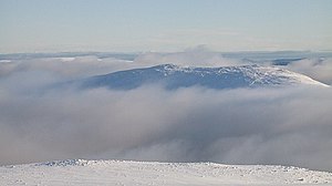
Càrn Dearg (Ben Alder)
| Càrn Dearg | ||
|---|---|---|
|
The Càrn Dearg, view from the northwestern neighbor Beinn a 'Chlachair |
||
| height | 1034 m ASL | |
| location | Highlands , Scotland | |
| Mountains | Grampian Mountains | |
| Notch height | 158 m | |
| Coordinates | 56 ° 51 '19 " N , 4 ° 27' 17" W | |
|
|
||
The Càrn Dearg is a Munro and Marilyn classified, 1034 meter high mountain in Scotland . Its Gaelic name can be roughly translated as red pointed mountain .
It is located in the Council Area Highland in the Grampian Mountains east of Fort William between Loch Ossian and Loch Ericht as part of a mountain range with a total of four Munros and various other peaks, running roughly from southwest to northeast. The mountain range is separated from the broad Ben Alder massif to the southeast by the broad Bealach Dubh , which is up to 722 meters above sea level .


The Càrn Dearg is the highest point of the section of the main ridge of the mountain range, which is somewhat separated from the three other Munros and about three kilometers to the northeast. To the southwest, the summit of the Càrn Dearg is joined by the 925 meter high pre-summit Dollaid a 'Chairn , via which there is also a transition to the neighboring Geal-Chàrn . To the northeast the ridge ends in a 827 meter high pre-summit towering over Loch Pattack . While the southeast and northwest sides of the Càrn Dearg drop steeply and are interspersed with rocks in the summit area, the two ridges to the northeast and southwest are less steep and offer opportunities for ascent.
Due to its location in uninhabited mountainous areas far away from public roads, climbing the Càrn Dearg is only possible with a bivouac and long hikes or using mountain bikes . Many Munro excavators climb the four peaks of the mountain range as part of a traverse along the main ridge, either starting with the ascent to the Càrn Dearg in the northeast via its northeast ridge or the Beinn Eibhinn in the southwest. The starting point is either Dalwhinnie in the northeast or Corrour Station in the southwest, both over 16 kilometers from Càrn Dearg. Culra Bothy at the foot of the Càrn Dearg on its southeast side as the only possible overnight stay in a wide area without using a tent has been closed since 2015 due to asbestos exposure .
Web links
- The Càrn Dearg on munromagic.com (English)
- The Càrn Dearg on walkhighlands.co.uk (English)
- Hill Bagging - the online version of the Database of British and Irish Hills: Càrn Dearg (English)
Individual evidence
- ↑ Càrn Dearg at www.munromagic.com , accessed July 3, 2020
- ↑ Mountain Bothies Association: Culra , accessed August 20, 2020

