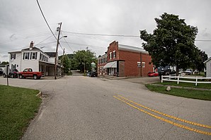
Cedar Grove, Indiana
| Cedar Grove | |
|---|---|
 |
|
| Location in Franklin County, Indiana | |
| Basic data | |
| State : | United States |
| State : | Indiana |
| County : | Franklin County |
| Coordinates : | 39 ° 21 ′ N , 84 ° 56 ′ W |
| Time zone : | Eastern ( UTC − 5 / −4 ) |
| Residents : | 156 (as of 2010) |
| Population density : | 390 inhabitants per km 2 |
| Area : | 0.4 km 2 (approx. Err mi 2 ) of which 0.4 km 2 (approx. 0 mi 2 ) is land |
| Height : | 183 m |
| Postal code : | 47016 |
| Area code : | +1 765 |
| FIPS : | 18-11044 |
| GNIS ID : | 0449633 |
Cedar Grove is a small town (with the status of " Town ") in Franklin County in the eastern part of the US -amerikanischen state of Indiana . In 2010 , Cedar Grove had 156 residents.
geography
The village is located at the confluence of Big Cedar Creek in the Whitewater River in the Highland Township . It has no significant bodies of water.
Neighboring towns are Mound Haven (4.8 km northwest), Sharptown (9.2 km east), New Trenton (7.6 km southeast), and Saint Leon (11.9 km south).
The closest major cities are Louisville , Kentucky (184 km southwest), Indiana's capital Indianapolis (130 km northwest), Fort Wayne (209 km north), Dayton , Ohio (102 km northeast), and Cincinnati (54.9 km southeast).
traffic
The US Highway 52 , which runs along the whitewater river, passing through the center of Cedar Grove. All other roads are subordinate routes or inner-city connecting roads.
The Cincinnati – Hagerstown railway line of the former Cleveland, Cincinnati, Chicago and St. Louis Railway runs parallel to Highway 52 and belongs to the RailAmerica subsidiary Central Railroad of Indiana (CIND) on the section between Cincinnati and Brookville .
The nearest airport is Cincinnati / Northern Kentucky International Airport , located 62.3 km southeast of Kentucky.
Demographic data
As of the 2010 census , Cedar Grove had 156 people in 75 households. The population density was 972.3 people per square kilometer. Statistically, 2.08 people lived in each of the 75 households.
Ethnically, the population consisted only of whites with two exceptions.
19.2 percent of the population were under 18 years old, 66.7 percent were between 18 and 64 and 14.1 percent were 65 years or older. 52.6 percent of the population was female.
The average annual income for a household was 53,750 USD . The per capita income was $ 32,122. 7.9 percent of the population lived below the poverty line.
Individual evidence
- ↑ 2010 Census US Gazetteer Files for Places - Indiana ( English , TXT) United States Census Bureau. Archived from the original on May 10, 2012. Info: The archive link was inserted automatically and has not yet been checked. Please check the original and archive link according to the instructions and then remove this notice. Retrieved August 14, 2012.
- ↑ a b American Fact Finder. Retrieved August 15, 2012
- ↑ Distance information according to Google Maps. Accessed August 15, 2012
- ↑ BNSF System Map (overview of all railways in the USA) ( Memento of the original from May 5, 2012 in the Internet Archive ) Info: The archive link was inserted automatically and has not yet been checked. Please check the original and archive link according to the instructions and then remove this notice. (PDF; 4.0 MB) Retrieved August 15, 2012
