Chandon (river)
| Chandon | ||
|
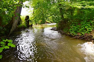
The Chandon at Chandossel |
||
| Data | ||
| Water code | CH : 225 | |
| location | Switzerland | |
| River system | Rhine | |
| Drain over | Broye → Zihl Canal → Rhine → North Sea | |
| Headwaters | in the field of Freiburger community Léchelles on Waldhügel La Bandeire 46 ° 49 '12 " N , 7 ° 1' 0 ' O |
|
| Source height | approx. 610 m above sea level M. | |
| muzzle | at Faoug in the Murten lake Coordinates: 46 ° 54 '22 " N , 7 ° 3' 27" E ; CH1903: 570 962 / 195 071 46 ° 54 '22 " N , 7 ° 3' 27" O |
|
| Mouth height | approx. 429 m above sea level M. | |
| Height difference | approx. 181 m | |
| Bottom slope | approx. 10 ‰ | |
| length | 17.3 km | |
| Catchment area | 38.19 km² | |
| Drain at the mouth |
MQ |
500 l / s |
The 17 km long Chandon is next to the Broye the second longest tributary of the Murten lake . It crosses areas of the Swiss cantons of Friborg and Vaud and drains a section of the Molasse plateau between the Broye plain and the Saane . It belongs to the catchment area of the Rhine .
Surname
The river name is made up of the Gallic word cambo (meander, curve) and the suffix -onna (watercourse).
geography
course
The headwaters of the Chandon are located at about 620 m above sea level. M. in the area of the Freiburg municipality of Léchelles on the forest hill La Bandeire . After a short run, it reaches the Léchelles basin (545 m above sea level). The Chandon leaves this to the northeast. It now runs in a well-developed valley with a flat floodplain that is always around 200 to 300 m wide in several turns through the Molasse plateau. During the retreat of the Ice Age Rhone Glacier, the Chandon Valley served as a meltwater channel for a long time. It is separated from the Broye plain to the northwest by the forest heights of the Grand Belmont and the Bois de Châtel and has an average gradient of less than 1%.
At the foot of the Bois de Châtel, the Chandon forms the border between Freiburg and the Vaudois exclave of Avenches for almost 3 km . After that he passes over completely to Freiburg soil. At Chandossel , the stream first draws an arc to the north, before turning to the west and crossing the canton border to Vaud. To the northeast of Avenches, the Chandon reaches the edge of the Broye plain. It then flows into Lake Murten with a small alluvial cone near Faoug .
Catchment area
The catchment area of the Chandon is 38.19 km² and consists of 28.2% wooded area , 64.1% agricultural area , 7.4% settlement area and 0.2% other areas.

The mean height of the catchment area is 568 m above sea level. M. , the minimum height is 429 m above sea level. M. and the maximum height at 737 m above sea level. M.
Tributaries
- Ruisseau les Craux ( left ), 0.2 miles
- Le Potéré ( right ), 2.9 km, 1.61 km²
- La Râpa ( right ), 1.2 km
- Le Châtelard ( right ), 1.2 km, 0.51 km²
- Le Rialet ( left ), 0.5 km
- La Bioleire ( left ), 0.6 km
- Le Ruisseau de Corsalettes ( Le Boverange ) ( right ), 6.9 km, 8.12 km², 0.11 m³ / s
- Le Ruisseau de la Rapellaz ( left ), 0.4 miles
- Le Ruisseau du Saut du Chien ( right ), 0.8 km
- La Fontaine à l'Ours ( left ), 0.5 km
- Le Ruisseau du Nitou ( right ), 2.2 km, 2.78 km²
- Le Ruisseau des Cornaches ( right ), 0.4 km
- Le Ruisseau du Grassey ( left ), 0.4 miles
- Le Ruisseau des Saules ( right ), 0.2 km
- Le Ruisseau des Baumes ( right ), 3.7 km, 6.75 km², 0.09 m³ / s
- Le Ruisseau du Cuenno ( right ), 1.6 km. 0.57 km²
- Le Ruisseau des Bruyeres ( left ), 0.5 km
Hydrology
At the confluence of the Chandon and the Murten lake, its modeled mean flow rate (MQ) is 0.50 m³ / s and its flow regime type is pluvial inférieur .
The modeled monthly mean discharge (MQ) of the Arbogne in m³ / s

character
The central reaches of the Chandon are still in their natural or near-natural state. In the agriculturally intensively used areas on the lower reaches and near Léchelles, the water was straightened in sections and the slopes reinforced. The Chandon is characterized by a pluvial runoff regime .
Mills
Its hydropower was previously used in various places to operate mills.
Individual evidence
- ↑ Geoserver of the Swiss Federal Administration ( information )
- ↑ a b c d Topographical catchment areas of Swiss waters: Chandon
- ↑ "Hidden behind the mean values" - the variability of the discharge regime , p. 7
