Avenches
| Avenches | |
|---|---|
| State : |
|
| Canton : |
|
| District : | Broye-Vully |
| BFS no. : | 5451 |
| Postal code : | 1580 |
| UN / LOCODE : | CH AVE |
| Coordinates : | 569 656 / 192175 |
| Height : | 480 m above sea level M. |
| Height range : | 429–646 m above sea level M. |
| Area : | 19.47 km² |
| Residents: | 4294 (December 31, 2018) |
| Population density : | 221 inhabitants per km² |
| Website: | www.commune-avenches.ch |
|
Historical old city |
|
| Location of the municipality | |
Avenches ([ avɑ̃ʃ ], in the native Franco-Provencal dialect [ aˈvɛ̃tsu ]) is a municipality in the Broye-Vully district in the Swiss canton of Vaud . The former German name Wiflisburg or Wifflisburg has been forgotten in the last two centuries despite the proximity to the language border and is hardly used today.
In Roman times, what was then Aventicum was the most important city on Swiss soil on the transit route from the Rhone Valley via Augusta Raurica to Germania.
On July 1, 2006, the Donatyre parish was merged with Avenches. On July 1, 2011, the municipality of Oleyres was also incorporated. As a result, the area of Avenches increased by around 3 km² and the population by almost 400.
geography
Avenches lies at an altitude of 480 m above sea level. M. between the district capital Payerne (10 km as the crow flies) and Murten (8 km as the crow flies). The medieval town extends on an isolated hill on the southern edge of the Broye plain , in the Swiss plateau southwest of Lake Murten .
The area of the 17.5 km² large municipal area includes a section of the Broye plain and the adjacent hill country. The entire northern part of the municipality is taken up by the intensively used plain of the lower Broye ( 435 m above sea level ), through which the Arbogne also flows. In the far north-west, in the area of the national stud, the area extends to the canalised Broye. In the north, an approx. 1.5 km long strip on the flat southern shore of Lake Murten belongs to the municipality, with the mouth of the Chandon forming the eastern boundary. To the south, the municipality extends into the Molasse hill country of Friborg, which was shaped by the Ice Age, on the plateaus of Donatyre and Chafeirou ( 510 m above sea level ). The wooded range of hills of the Bois de Châtel, on which at 630 m above sea level. M. the highest point of the municipality is reached, belongs to Avenches. The western boundary is in parts of the Ruisseau de Coppet brook . In 1997, 14% of the municipal area was in settlements, 15% in forest and woodland, 70% in agriculture and a little less than 1% was unproductive land.
The village of Donatyre ( 505 m above sea level ) on a plateau north of the Bois de Châtel and numerous individual farms belong to Avenches . Neighboring municipalities to Avenches are Vully-les-Lacs and Faoug in the canton of Vaud and Saint-Aubin , Belmont-Broye , Misery-Courtion and Courtepin in the canton of Friborg .
population
With 4294 inhabitants (as of December 31, 2018), Avenches is one of the medium-sized municipalities in the canton of Vaud. 74.1% of the residents are French-speaking, 12.8% German-speaking and 5.8% Portuguese-speaking (as of 2000). The population of Avenches was 1637 inhabitants in 1850, 1952 inhabitants in 1900 (each excluding Donatyre). After the population had decreased by 20% to 1565 by 1941, a significant increase in population has been observed since then, especially in the years from 1960 to 1970.
economy
Avenches is a regional economic and trade center and the center of an area that is strongly oriented towards agriculture. The town was therefore dominated by agriculture for a long time. Even today, more than 14% of the workforce work in the primary sector, while the secondary sector accounts for around 28% and the service sector for around 56% of the workforce.
Since the correction of the Broye in 1906, Avenches has had a large area of fertile farmland in the plain north of the town. Mainly grain, tobacco, various vegetables and sugar beets are grown here. In the hilly southern part of the municipality there is not only agriculture, but also fruit growing and cattle breeding .
The land between the Arbogne and the Broye in the west of Avenches was bought by the federal government in 1899, which then established the Federal Stud, a state horse breeding establishment, until 1901. It was privatized in 1997 and is now called the Avenches National Stud (French: Haras National Avenches ). Every year races take place on the horse racing track of the Institut Équestre National Avenches (IENA). The 2003 cross-country championships were held here.
The industrialization took place very slowly in Avenches. Since the 19th century there were some companies that processed the agricultural products of the area. Only after 1945 did other companies establish themselves. Today there are numerous small and medium-sized companies in the construction, concrete production (Holcim Granulats et Bétons SA), food and chemical industry, horticulture, telecommunications and precision engineering sectors.
Avenches is also a regional service center and location of the district administration as well as the seat of several banks and insurance companies. With the connection to the A1 motorway at the end of the 1990s, Avenches also developed into an attractive place to live. New residential quarters emerged, especially on the northern slope of the hill and south of the old town. A significant proportion of the workforce commutes to work in Friborg or Bern .
On October 5, 2007, Yahoo announced that it would expand a location in Avenches. In 2013, however, these plans were rejected again.

tourism
With its Roman ruins, the Musée Romain, the historic old town and cultural events, Avenches has a lot to offer. The most important cultural event is the annual opera festival in the amphitheater. There is a campsite and a sports boat harbor on the southern shore of Lake Murten.
traffic
The community has good transport connections. It is on the main road 1 from Bern via Payerne to Lausanne , which was busy before the opening of the motorway. The Bern-Payerne section of the A1 motorway with the Avenches exit has been continuously passable since the end of 1997; the gap between Payerne and Yverdon-les-Bains was closed in 2001. Avenches has been on the transit axis from western Switzerland to Bern since then.
On August 25, 1876, the Murten -Payerne railway line with a train station in Avenches went into operation. Bus routes connect Avenches with Freiburg , Domdidier , Mur and Cudrefin .
history
The roots of Avenches go back to the Celts . A tribe of the Helvetii had in the course of the 1st century BC An oppidum was built at the height of the Bois de Châtel south of the later Roman town . This oppidum probably replaced an earlier oppidum on Mont Vully , which was abandoned around the same time.
The foundation of the Roman city Colonia Pia Flavia Constans Emerita Helvetiorum Fœderata, as it was officially called, or Aventicum , as the local population said, is believed to date from around 15-13 BC. BC. According to older name research, the name Aventicum is said to be derived from a Helvetian source goddess Aventia ; today it is traced back to the Celtic brook name Aventǐa , which was extended by the suffix -ǐko / -ǐcum . The place is first mentioned by Tacitus , who in 69 already referred to it as the capital of the Helvetii (caput gentis) . Aventicum soon developed into a flourishing trading town with around 20,000 inhabitants and eventually became a bishopric. The decline of the Roman city began in the 3rd century AD, caused by internal turmoil and raids by the Alemanni . As a result, the remaining residents settled on the hill where today's town is. A new fortified settlement was re-established on the site of the Roman city in the 5th century. Aventicum remained a bishopric even during the troubled times and the ongoing threat from the Alamanni and had at least two churches (Saint-Martin and Saint-Symphorien). It was not until the middle of the 6th century, when Bishop Marius moved his seat to Lausanne , that this marked the end of Aventicum. The place was probably still inhabited.
In 1074, the Lausanne bishop Burkhard von Oltigen founded a new city on the hill of what is now today's town, which was known in the Middle Ages under the Latinized name Adventica and first appeared in the vernacular in 1349 in the vernacular Avenchoz, 1518 Avenche . The German name Wiflisburg, which corresponds neither with the Latin nor with the French variant, goes back to an early Alemannic settler named Wibili and is first documented as Wibilsburg in 1266 (1258?) ; Later evidence is Wipelspurg (1302), Wibelspurg (1458), Wiblispurg (1476), Wiflispurg (1548) and Wiflisburg (1577).
The city was surrounded by a curtain wall in the 11th century and received city charter in 1259, which was presumably based on freedoms granted in the 11th century but not historically secured. Avenches, under the protection of the Bishop of Lausanne, entered into an alliance with Freiburg in 1239 and one with Murten in 1353 . The bishop's representative was a kastlan who resided in the 13th century castle.
With the conquest of Vaud by Bern in 1536, Avenches came under Bernese rule and became the seat of the Avenches bailiff. In addition to the area of today's district, this also included the Grandcour rule north of Payerne. After the collapse of the Ancien Régime , Avenches was annexed to the canton of Friborg during the Helvetic Republic in 1798 . As early as 1801, the residents were pushing for a connection to the canton of Léman. With the entry into force of the Mediation Constitution in 1803, this request was granted and Avenches, together with the current district area, was incorporated into the canton of Vaud as an exclave. Avenches has been the district capital ever since.
Since 1826, a community of Jews who immigrated from Alsace developed in Avenches . They mainly farmed horses and built a synagogue in 1865 . After the economic situation deteriorated towards the end of the 19th century, they moved to larger cities. The synagogue, which was no longer in use, was demolished in 1954. A memorial plaque is placed at this point. The Star of David on the tower de Vully still reminds of the Jewish residents of the city.
Since 1910 there was an airfield on the flat terrain north of the city, which served as an army base during the First World War . It was originally intended to be expanded into a military airfield, but was closed in 1921 with the opening of the new military airfield in Payerne .
On July 1, 2006, the previously politically independent municipality of Donatyre merged with Avenches, after the electorate of both municipalities in June 2005 voted with a large majority in favor of the union. On July 1, 2011, the municipality of Oleyres was also incorporated.
Attractions
Old town
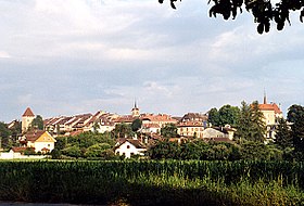
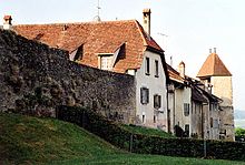
Avenches has a well-preserved historic old town with a picturesque medieval townscape. It is located on a hill that overlooks the Broye plain by around 40 m. The old town with a rectangular floor plan has an area of 300 × 200 m. The old main road from Payerne to Murten forms the central longitudinal axis. To the south and north of it there is a side street, which are connected by three cross streets. The Tour de Benneville (in the south) and the Tour de Vully (in the northeast) have been preserved from the former city fortifications; both date from the 13th century. The city wall was razed in the 19th century. The tower on the edge of the amphitheater, built in the 11th century, was probably part of the curtain wall. Since 1838 it has housed the Musée Romain with a rich collection of excavation finds from the Roman city of Aventicum.
The reformed church of Sainte-Marie-Madeleine was built in the center of the old town at the end of the 11th century and replaced the earlier Merovingian houses of worship outside the city walls, which gradually fell into disrepair and were completely torn down in the 17th century. It was rebuilt during the Gothic style period and from 1709 to 1711. The Romanesque round apse has been preserved from the original building .
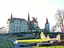
The castle is in the northeast corner of the old town. It was built as a castle in the 13th century and was initially the seat of the Kastlans, since 1536 of the bailiff appointed by Bern. From 1565 to 1568 he had a fundamental redesign to the present day renaissance castle . It has a rich interior and today houses the city library.
In the old town, the three-storey Hôtel de Ville (town hall) built in 1753 with a carved gable triangle and arcades, the Hôtel de la Couronne and the Tour de Montauban, a polygonal stair tower of a former manor house from the 15th century, should also be mentioned. The Grand-Rue (main street) is lined with numerous stately late Gothic town houses and patrician houses from the 16th to 18th centuries.
Roman city of Aventicum
Significant remains of the Roman city of Aventicum have also been preserved or excavated, restored and conserved. The best-preserved amphitheater in Switzerland is located at the eastern exit of the historic old town . Above the main entrance is the 11th century defense tower, formerly known as the Bischofsturm. The Avenches Opéra Festival is held in the amphitheater .
To the south of the former Aventicum is the Roman theater (Théâtre romain).
Other significant remains are from the temple complex of Cigognier, the Capitol, the thermal baths and the former Roman enclosing wall. Of the Cigognier Temple, there is only a 12 m high column on which storks used to nest, which is why the temple got its name from the French word cigogne (stork).
literature
- Christine Lauener: Avenches (community). In: Historical Lexicon of Switzerland .
- Nathalie Desarzens: The city of Avenches. (Swiss Art Guide, No. 945, Series 95). Edited by the Society for Swiss Art History GSK. Bern 2014, ISBN 978-3-03797-135-2 .
Web links
- Avenches municipality tourist website
- Avenches on the ETHorama platform
Individual evidence
- ↑ Permanent and non-permanent resident population by year, canton, district, municipality, population type and gender (permanent resident population). In: bfs. admin.ch . Federal Statistical Office (FSO), August 31, 2019, accessed on December 22, 2019 .
- ↑ a b Lexicon of Swiss municipality names . Edited by the Center de Dialectologie at the University of Neuchâtel under the direction of Andres Kristol. Verlag Huber, Frauenfeld / Stuttgart / Vienna 2005, ISBN 3-7193-1308-5 and Éditions Payot, Lausanne 2005, ISBN 2-601-03336-3 , p. 110 f.
- ↑ Yahoo leaves Switzerland. on netzwoche.ch, August 30, 2013
- ^ Charles Knapp, Maurice Borel, Victor Attinger, Heinrich Brunner, Société neuchâteloise de geographie (editor): Geographical Lexicon of Switzerland . Volume 1: Aa - Emmengruppe . Verlag Gebrüder Attinger, Neuenburg 1902, pp. 108-113, keyword Avenches ( scan of the lexicon page ).


