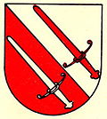
Oulens-sur-Lucens
| Oulens-sur-Lucens | ||
|---|---|---|
| State : |
|
|
| Canton : |
|
|
| District : | Broye-Vully | |
| Municipality : | Lucens | |
| Postal code : | 1522 | |
| Coordinates : | 551 797 / 172 745 | |
| Height : | 633 m above sea level M. | |
| Area : | 1.59 km² | |
| Residents: | 52 (December 31, 2010) | |
| Population density : | 33 inhabitants per km² | |
| map | ||
|
|
||
Oulens-sur-Lucens was a municipality in the Broye-Vully district in the canton of Vaud in Switzerland . On July 1, 2011, she went up in the Lucens parish .
geography
Oulens-sur-Lucens lies at 633 m above sea level. M. , 16 kilometers southwest of the district capital Payerne (linear distance ). The small farming village extends over a terrace on the western slope of the Cerjaule , in the Molasse hill country of the northern Vaudois Central Plateau .
The area of the 1.6 km² municipal area covers a section of the Vallon des Vaux . This valley is traversed by the Cerjaule , a left side brook of the Broye . On the eastern side of the valley, the Bois des Côtes forest area belongs to Oulens-sur-Lucens. To the west of the creek, the communal soil extends to the adjacent slopes of the Molasse hill country and reaches below Villars-le-Comte at 698 m above sea level. M. the highest point of Oulens-sur-Lucens. In 1997, 8% of the municipal area was accounted for by settlements, 35% by forests and woodlands and 57% by agriculture.
Several individual farms belong to Oulens-sur-Lucens. Neighboring municipalities of Oulens-sur-Lucens were Lucens, Bussy-sur-Moudon , Neyruz-sur-Moudon , Villars-le-Comte and Forel-sur-Lucens .
population
With 52 inhabitants (as of December 31, 2010) Oulens-sur-Lucens was one of the smallest municipalities in the canton of Vaud. In 2000, 100% of residents said French was their main language. The population of Oulens-sur-Lucens was 96 in 1900. After that, a decrease of more than 60% to 37 inhabitants was recorded by 1980 due to strong emigration; since then the population has increased slightly again.
economy
Oulens-sur-Lucens was a predominantly agricultural village until the second half of the 20th century . Even today, arable farming , fruit growing and cattle breeding play an important role in the income structure of the population. There are hardly any jobs in the village outside of the primary sector. The water power of the Cerjaule was previously used by a mill. In the last few decades the village has also developed into a residential community. Some workers are therefore commuters who work in the surrounding larger towns.
traffic
The community is located off the major thoroughfares, but is relatively easy to reach from Lucens . Oulens-sur-Lucens is connected to the public transport network by a postbus course that runs from Moudon via Villars-le-Comte to Thierrens .
history
The place was first mentioned in a document in 595 under the name of Ollens . Later the names Oulyn , Ollo , Dou Lyn and Dou Lin appeared . The place name goes back to the Burgundian personal name Ollo (derived from Adlo , Audilo or Odilo ) and means for the people of Ollo .
Since the Middle Ages, Oulens-sur-Lucens has been under the Savoy Bailiwick of Lucens. With the conquest of Vaud by Bern in 1536, the village came under the administration of the Moudon Bailiwick . After the collapse of the Ancien Régime , Oulens-sur-Lucens belonged to the canton of Léman from 1798 to 1803 during the Helvetic Republic , which then became part of the canton of Vaud when the mediation constitution came into force . In 1798 it was assigned to the Moudon district.
Attractions
literature
- Monique Fontannaz, Brigitte Pradervand: “Le district de la Broye-Vully 1.” (= The art monuments of Switzerland. Volume 128). Ed. Society for Swiss Art History SKG. Bern 2015, pp. 306–307, ISBN 978-3-03797-180-2 .
Web links
- Community information
- Emmanuel Abetel: Oulens-sur-Lucens. In: Historical Lexicon of Switzerland .
- Aerial views of the village


