
Lovatens
| Lovatens | |
|---|---|
 |
|
| State : |
|
| Canton : |
|
| District : | Broye-Vully |
| BFS no. : | 5674 |
| Postal code : | 1682 |
| Coordinates : | 556 036 / 171292 |
| Height : | 712 m above sea level M. |
| Height range : | 537–811 m above sea level M. |
| Area : | 3.47 km² |
| Residents: | 146 (December 31, 2018) |
| Population density : | 42 inhabitants per km² |
| Website: | www.lovatens.ch |
 Lovatens |
|
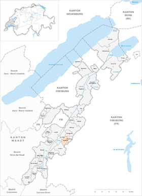
| Location of the municipality | |
  |
|
Lovatens is a municipality in the Broye-Vully district in the canton of Vaud in Switzerland .
geography
Lovatens is 712 m above sea level. M. , 15.5 km southwest of the district capital Payerne (linear distance). The farming village extends over a panoramic terrace on the upper right valley slope of the Broye , in the eastern Swiss Plateau .
The area of the 3.5 km² municipal area comprises a section of the Molasse hill country between the Broyetal and the upper reaches of the Glâne . The main part of the area is taken up by the wide terrace of Lovatens (around 700 m above sea level ). To the west the slope descends towards the Broye valley and is divided by two small valleys, which feed their water to the Ruisseau des Vaux , a right side brook of the Broye. This brook, which runs in an erosion valley cut deep into the slope , also forms the western border of the municipality. To the east, the municipality extends to the forest hill Bois de Verrey (up to 800 m above sea level ) and reaches Champ Liamon at 810 m above sea level. M. the highest point of Lovatens. In 1997, 3% of the municipal area was accounted for by settlements, 17% for forests and woodlands and 80% for agriculture.
Several individual farms belong to Lovatens. Neighboring communities of Lovatens are Lucens , Curtilles , Dompierre and Prévonloup in the canton of Vaud and Billens-Hennens in the canton of Friborg .
population
With 146 inhabitants (as of December 31, 2018) Lovatens is one of the small communities in the canton of Vaud. 92.7% of the residents are French-speaking, 4.6% German-speaking and 2.0% English-speaking (as of 2000). The population of Lovatens was still 256 in 1900. After that, a decrease of around 60% to 103 inhabitants was recorded by 1980 due to strong emigration; since then, however, the population has increased significantly again.
economy
Lovatens was a predominantly agricultural village until the second half of the 20th century . Even today, arable farming , fruit growing and cattle breeding play an important role in the income structure of the population. Further jobs are available in local small businesses and in the service sector. With the construction of a few single-family houses in the last few decades, the village has also developed into a residential community. Some workers are therefore commuters who work in the surrounding larger towns.
traffic
The community is located off the main thoroughfares, but can be easily reached from the connecting road from Lucens to Romont . Lovatens is connected to the public transport network through a post bus course that runs from Moudon to Lucens.
history
Some remains from Roman times have been found in the municipality . The first written mention of the place took place in 996 under the name Lovatingis in a document of the monastery Saint-Maurice . In the 13th century the term Lovartens appeared , and the spelling Lovattens was often used until around 1900 . The place name probably goes back to the Burgundian personal name Laudewald and means for the people of Laudewald . Other sources attribute the origin of the place name to the Latin word lupus (wolf).
With the conquest of Vaud by Bern in 1536, Lovatens came under the administration of the Moudon Bailiwick . After the collapse of the Ancien Régime , the village belonged to the canton of Léman from 1798 to 1803 during the Helvetic Republic , which then became part of the canton of Vaud when the mediation constitution came into force . In 1798 it was assigned to the Moudon district.
Attractions
Lovatens has a small chapel, a village schoolhouse with a bell tower and some characteristic farmhouses from the 18th and 19th centuries.
literature
- Monique Fontannaz, Brigitte Pradervand: Le district de la Broye-Vully 1. (= The art monuments of Switzerland. Volume 128). Ed. Society for Swiss Art History SKG. Bern 2015, pp. 304–306, ISBN 978-3-03797-180-2 .
Web links
- Official website of the Municipality of Lovatens (French)
- Jean-Jacques Bouquet: Lovatens. In: Historical Lexicon of Switzerland .
- Aerial views of the village
Individual evidence
- ↑ Permanent and non-permanent resident population by year, canton, district, municipality, population type and gender (permanent resident population). In: bfs. admin.ch . Federal Statistical Office (FSO), August 31, 2019, accessed on December 22, 2019 .
Avenches | Bussy-sur-Moudon | Champtauroz | Chavannes-sur-Moudon | Chevroux | Corcelles-le-Jorat | Corcelles-près-Payerne | Cudrefin | Curtilles | Dompierre | Faoug | Grandcour | Henniez | Hermenches | Lovatens | Lucens | Missy | Moudon | Payerne | Prévonloup | Ropraz | Rossenges | Syens | Trey | Treytorrens (Payerne) | Valbroye | Villars-le-Comte | Villarzel | Vucherens | Vulliens | Vully-les-Lacs
Former parishes: Bellerive | Brenles | Carrouge | Cerniaz | Chabrey | Champmartin | Chesalles-sur-Moudon | Combremont-le-Grand | Combremont-le-Petit | Constantine | Cremin | Forel-sur-Lucens | Donatyre | Granges-près-Marnand | Marnand | Montmagny | Mur | Oleyres | Oulens-sur-Lucens | Rossens | Sarzens | Sassel | Sédeilles | Seigneux | Vallamand | Villars-Bramard | Villars-le-Grand
Canton of Vaud | Districts of the canton of Vaud | Municipalities of the canton of Vaud