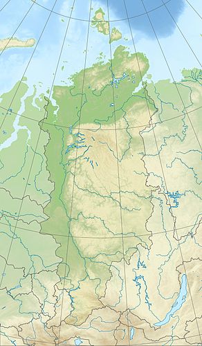
Chantai Lake
| Chantai Lake | ||
|---|---|---|
| Geographical location | Krasnoyarsk Region ( Russia ) | |
| Tributaries | Irbe , Kutaramakan , Nalednaya , Edyngde , Khakancha | |
| Drain | Small Lake Chantaika → Chantaika → Yenisei | |
| Places on the shore | Chantaiskoje Osero | |
| Data | ||
| Coordinates | 68 ° 20 ′ N , 91 ° 0 ′ E | |
|
|
||
| Altitude above sea level | 73 m | |
| surface | 822 km² | |
| length | approx. 100 km | |
| width | approx. 13 km | |
| Maximum depth | approx. 420 m | |
| Catchment area | 11,900 km² | |
The Chantaisee ( Russian Озеро Хантайское , Ozero Chantaiskoje), in some sources also Big Chantaisee (Озеро Большое Хантайское) or Kutarmosee called (Озеро Кутармо), is an approximately 822 square kilometers large lake at the Khantayka River in putorana plateau , the northwestern part of the central Siberian highlands , located each in the Taimyr Autonomous Okrug , in the north of the Krasnoyarsk Territory , in Siberia and Russia ( Asia ). At 420 m it is the second deepest lake in Russia after Lake Baikal .
Geographical location
The Chantaisee lies on average almost 200 km north of the Arctic Circle in the western foothills of the Putorana Mountains (max. 1701 m ), where it extends in a west-east direction at the eastern Yenisei tributary Chantaika . To the west, the landscape gradually descends over the Kleiner Chantaikaee and Chantaikastausee , partly with a hilly landscape, into the eastern foothills of the West Siberian lowlands .
The Chantaisee is located at about 65 m in a narrow tectonic depression. It is over 100 km long and up to 13 km wide. Especially in the eastern part, like most of the lakes in the Putorana Mountains, with its mountains rising steeply on both sides, over 1000 m and east of its eastern arms up to 1262 m high and in the summit area mostly flattened mountains, reminds of fjords .
The Chantaisee is traversed by the Chantaika, which runs roughly in an east-west direction, which then flows through the Kleiner Chantaikaee , which is at the same height, and the Chantaikastausee, which is about 60 m high, to ultimately flow into the Yenisei . The streams that flow into the lake include: Irbe , Kutaramakan , Nalednaya , Edyngde and Chakancha .
The village of Khantaiskoje Osero is located on a peninsula on the southwestern shore of Lake Khantai, near the confluence of the Khakancha, which comes from the southeast . Otherwise the shores of the lake are uninhabited.
exploration
The Khantaisee and its surroundings were explored during expeditions by the Russian explorer Alexander Sotnikow (1891-1920) in 1915 and by the Russian-Soviet geologist and polar explorer Nikolai Urwanzew (1893-1985) in 1919.
Climate, flora and fauna
The region of Lake Chantai lies in the area of permafrost . The lake is covered by ice from October to June or July every year . Boreal coniferous forests (taiga) thrive on its banks and the tundra with its mosses and lichens dominates the surrounding mountains . For example, perch fish , pike and salmon fish live in the fish-rich lake .
Individual evidence
- ↑ a b Lake Chantai in the State Water Directory of the Russian Federation (Russian)
- ↑ a b Article Chantaisee in the Great Soviet Encyclopedia (BSE) , 3rd edition 1969–1978 (Russian)
- ↑ Bolshoi Enziklopeditscheski Slowar (Large Encyclopedic Dictionary). Moscow, 1991 (Russian)
-
↑ Topographic map (1: 500.000, p. R-46, D, edition 1988), eastern part of Lake Chantai (bottom left) and a. with from right influent Khantayka River , Lake Keta (center left) and Lake Lama (top left); on mapr46.narod.ru (with heights above sea level )
see also connection and detailed maps:
- Topographic map (1: 200.000, p. R-46-XXXI, XXXII, edition 1988), middle part of Lake Chantai; on mapr46.narod.ru
- topographic map (1: 200.000, p. R-45-XXXV, XXXVI, edition 1989), western part of Lake Chantai (center right) and a. with small Chantaika lake (center), Chantaika reservoir (far left) and the three still waters connecting Chantaika ; on mapr45.narod.ru
