Charlois (Rotterdam)
 flag |
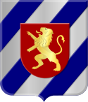
 coat of arms |
| province |
|
| local community |
|
|
Area - land - water |
11.90 km 2 11.19 km 2 0.71 km 2 |
| Residents | 67,270 (Jan. 1, 2018) |
| Coordinates | 51 ° 53 ′ N , 4 ° 29 ′ E |
| Important traffic route |
|
| prefix | 010 |
| Postcodes | 3081-3089 |
| Location of the Charlois district in Rotterdam | |
Charlois (pronunciation sjaarloos / 'ʃaːrlo u s / (Dutch), /' ʃaːɻlɜus / (Rotterdam dialect)) is a district of Rotterdam and lies on the southern bank of the Meuse . On January 1, 2018, Charlois had 67,270 inhabitants.
Charlois is divided into the districts of Carnisse, Heijplaat, Oud-Charlois, Pendrecht, Tarwewijk, Wielewaal, Zuidwijk and Zuidplein.
history
1462 is the founding year of Charlois, which was incorporated into Rotterdam in 1895.
Individual evidence
- ↑ a b Kerncijfers wijken en buurten 2018 . In: StatLine . Centraal Bureau voor de Statistiek , March 29, 2019, accessed June 20, 2019 (Dutch)
- ↑ Oud-Charlois on the City of Rotterdam website, accessed on June 18, 2019 (Dutch).
